Elite Wall Decor
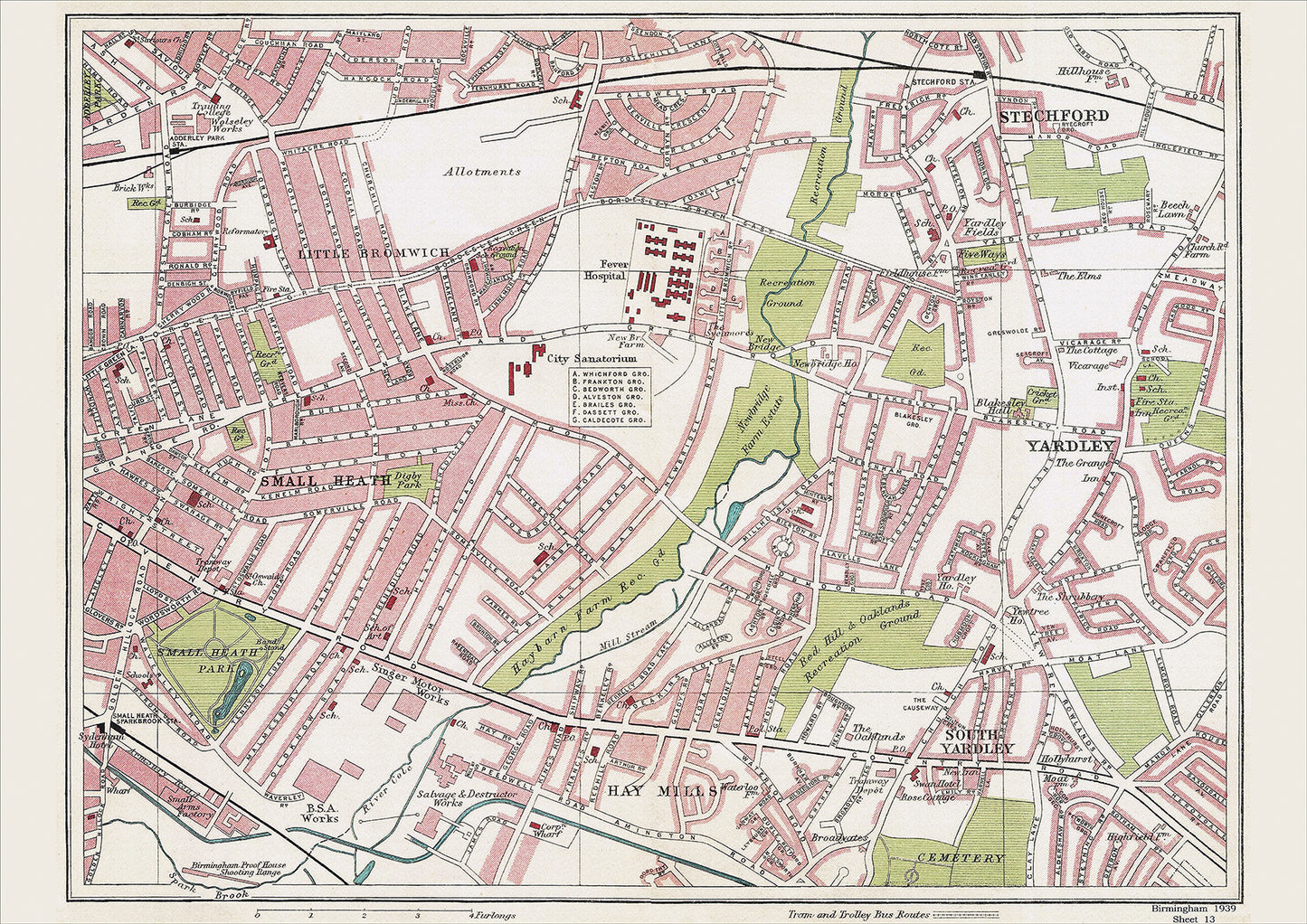
Birmingham in 1939 Series - Small Heath, Yardley, Stetchford, Little Bromwich, Hay Mills, South Yardley area (Bir1939-13)
Birmingham in 1939 Series - Small Heath, Yardley, Stetchford, Little Bromwich, Hay Mills, South Yardley area (Bir1939-13)
Couldn't load pickup availability
This digital download is a high-quality 300dpi JPG image of a street atlas map dated 1939. It is enlarged, and sized to print if required at A2 dimensions (59.4 cm x 42 cm), making it perfect for framing or use in a project. Or simply view it in close up on your computer screen using Windows Photo or similar.
This series of 1939 maps of Birmingham shows (where present) roads, farms, public buildings (such as hospitals, libraries, town halls, churches, schools, colleges, museums, gas works, sewage works, etc) , larger houses, woods, rivers, estates and parks. They also show footpaths, ponds and lakes.
These maps are sharp and clear.
All railway lines and stations are shown and named.
FOR PRINTED MAPS, PLEASE VISIT https://www.ebay.co.uk/str/wealdenrelics