Elite Wall Decor
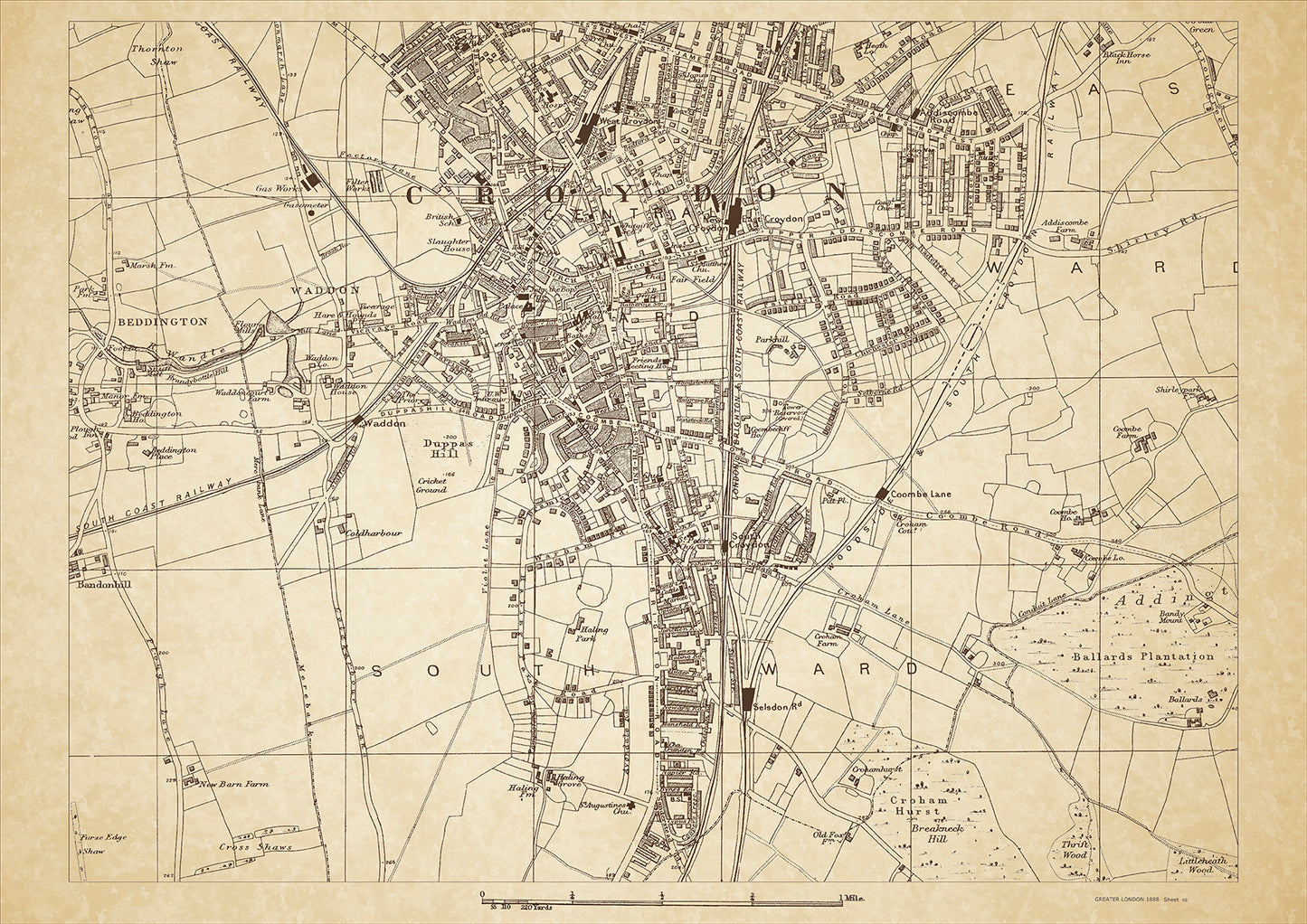
Greater London in 1888 Series - showing Croydon - sheet 48
Greater London in 1888 Series - showing Croydon - sheet 48
Couldn't load pickup availability
This digital download is a high-quality 300dpi JPG image of a London street atlas map dated 1888. It is enlarged, and sized to print if required at A2 dimensions (59.4 cm x 42 cm), or simply view it in close up on your computer screen using for instance Windows Photo or similar.
These maps are sharp and clear. All railway lines and stations are shown and named.
In 1888, Croydon was a rapidly growing suburban town on the outskirts of London. It was known for its many parks and gardens, including the newly established Queen's Gardens, which had opened the previous year. The town was also home to several notable buildings, such as the Croydon Parish Church and the clock tower, which was built in 1877 and still stands today.
Croydon was inhabited by a diverse population, with a mix of upper-middle-class residents and working-class families. The town's growth was driven by the arrival of the railway in the mid-19th century, which made it easier for people to commute to London for work.
In addition to its parks and gardens, Croydon was also known for its thriving shopping district, with many department stores and shops lining the main streets. The Surrey Street Market, which had been in operation since the 13th century, was also a popular destination for locals and visitors alike.
Whether you're a history buff, a cartography enthusiast, or simply looking for a unique piece of decor for your home or office, this map is sure to delight. It's a piece of history that you can own and enjoy for years to come.