Elite Wall Decor
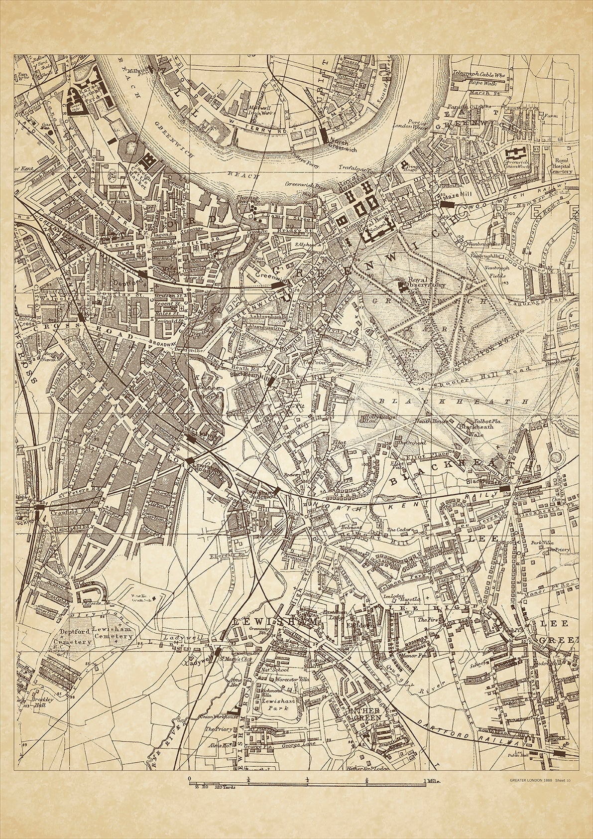
Greater London in 1888 Series - showing Greenwich, Deptford, Lewisham, Blackheath, Hither Green, Lee, Lee Green - sheet 30
Greater London in 1888 Series - showing Greenwich, Deptford, Lewisham, Blackheath, Hither Green, Lee, Lee Green - sheet 30
Couldn't load pickup availability
This digital download is a high-quality 300dpi JPG image of a London street atlas map dated 1888. It is enlarged, and sized to print if required at A2 dimensions (59.4 cm x 42 cm), or simply view it in close up on your computer screen using for instance Windows Photo or similar.
These maps are sharp and clear. All railway lines and stations are shown and named.
In 1888, Greenwich, Deptford, and Lewisham were all part of the sprawling metropolis of London, which was undergoing rapid growth and transformation during the Victorian era. These areas were primarily residential, with a mix of working-class and middle-class residents.
Greenwich, located on the south bank of the River Thames, had a long history as a center of maritime activity. The Royal Observatory, established in the late 17th century, was a major attraction for astronomers and tourists alike. Other notable landmarks in Greenwich included the Old Royal Naval College, the National Maritime Museum, and the Cutty Sark, a historic sailing ship.
Deptford, located just west of Greenwich, was also a hub of maritime activity, with a bustling port and shipyards. The area was known for its working-class population, many of whom were employed in the shipbuilding industry. The historic St. Nicholas Church, built in the 14th century, was a notable landmark in Deptford.
Lewisham, located to the southeast of Greenwich, was a more suburban area with a mix of residential and commercial development. One of the area's most notable landmarks was Lewisham Hospital, which had been established in the mid-19th century and served the local community.
In 1888, these areas were also impacted by the infamous Jack the Ripper murders, which occurred primarily in the Whitechapel district of East London but had ripple effects throughout the city. The murders highlighted the poverty, crime, and social inequality that existed in many parts of Victorian London.
Overall, in 1888, Greenwich, Deptford, and Lewisham were diverse and vibrant parts of London, with rich histories and a mix of working-class and middle-class residents. Today, visitors can still explore many of the historic landmarks and buildings that remain from this era.
Whether you're a history buff, a cartography enthusiast, or simply looking for a unique piece of decor for your home or office, this map is sure to delight. It's a piece of history that you can own and enjoy for years to come.