Elite Wall Decor
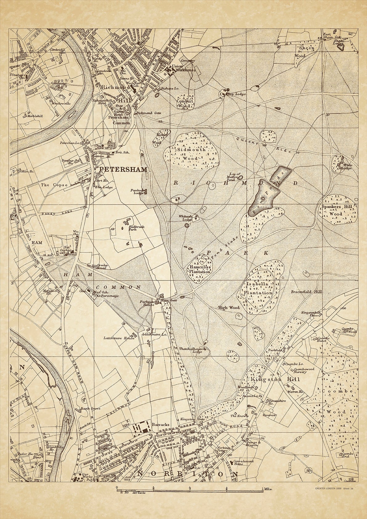
Greater London in 1888 Series - showing Petersham, Norbiton (north), Richmond Park, Richmond Hill, Kingston Hill - sheet 34
Greater London in 1888 Series - showing Petersham, Norbiton (north), Richmond Park, Richmond Hill, Kingston Hill - sheet 34
Couldn't load pickup availability
This digital download is a high-quality 300dpi JPG image of a London street atlas map dated 1888. It is enlarged, and sized to print if required at A2 dimensions (59.4 cm x 42 cm), or simply view it in close up on your computer screen using for instance Windows Photo or similar.
These maps are sharp and clear. All railway lines and stations are shown and named.
Petersham and Norbiton were two distinct areas of London in 1888 with their own unique histories and landmarks. Petersham was a small village located on the outskirts of London in the borough of Richmond-upon-Thames. It was known for its scenic views of the Thames river, rolling hills, and open meadows. The area was predominantly rural with farms and small cottages, although there were a few large houses owned by wealthy families.
Norbiton, on the other hand, was a more developed urban area located just south of Kingston upon Thames. It was a popular destination for commuters who worked in central London due to its location near several train stations. The area was known for its grand Victorian houses, many of which were owned by upper-middle-class families. There were also several public parks, including Norbiton Common and Richmond Park, which was accessible via Kingston Gate.
Both Petersham and Norbiton were home to several historical landmarks in 1888. In Petersham, one of the most notable buildings was Petersham House, a grand 17th-century mansion owned by the Earl of Dysart. The house was known for its beautiful gardens and collection of fine art. Norbiton was home to the Hogsmill River, which was famously depicted in John Everett Millais' painting, Ophelia. The river flowed through Norbiton Common, which was a popular spot for picnics and leisure activities.
Overall, Petersham and Norbiton were two distinct areas of London in 1888 with their own unique histories, landmarks, and class of people who lived there. Petersham was a rural village with farms and small cottages, while Norbiton was a more developed urban area with grand Victorian houses owned by upper-middle-class families.
Whether you're a history buff, a cartography enthusiast, or simply looking for a unique piece of decor for your home or office, this map is sure to delight. It's a piece of history that you can own and enjoy for years to come.