Elite Wall Decor
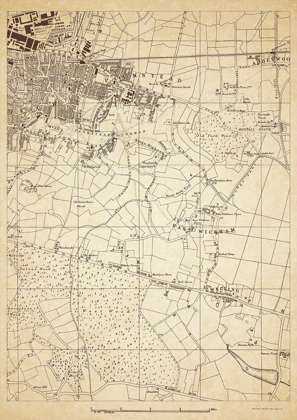
Greater London in 1888 Series - showing Welling, East Wickham, Plumstead, Woolwich (east), Abbey Wood (west) - sheet 32
Greater London in 1888 Series - showing Welling, East Wickham, Plumstead, Woolwich (east), Abbey Wood (west) - sheet 32
Couldn't load pickup availability
This digital download is a high-quality 300dpi JPG image of a London street atlas map dated 1888. It is enlarged, and sized to print if required at A2 dimensions (59.4 cm x 42 cm), or simply view it in close up on your computer screen using for instance Windows Photo or similar.
These maps are sharp and clear. All railway lines and stations are shown and named.
In 1888, Welling, East Wickham, and Plumstead were largely rural areas that were gradually becoming more developed. Welling was home to many farmers and agricultural workers, while East Wickham had a mix of farmers and workers who commuted to work in the city. Plumstead was known for its military presence, with the Royal Arsenal located there.
Historical places of interest in the area included the Royal Arsenal, which was one of the largest armament factories in the world at the time. The site included various workshops, laboratories, and offices, as well as the Royal Military Academy. Visitors could also tour the Royal Artillery Museum and the Woolwich Grand Theatre.
The class of people living in these areas varied, but were largely working-class or lower-middle class. Many residents worked in the Royal Arsenal or in other industries, such as brick-making or leather-working. The area was also home to a number of pubs, shops, and small businesses that catered to the local population. As the railways expanded, more people were able to commute to work in the city, which contributed to the gradual urbanization of these formerly rural areas.
Whether you're a history buff, a cartography enthusiast, or simply looking for a unique piece of decor for your home or office, this map is sure to delight. It's a piece of history that you can own and enjoy for years to come.

