Elite Wall Decor
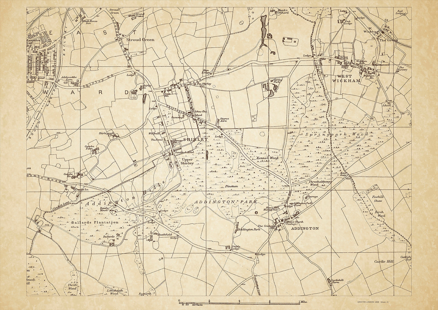
Greater London in 1888 Series - showing West Wickham, Addington, Shirley, Stroud Green - sheet 49
Greater London in 1888 Series - showing West Wickham, Addington, Shirley, Stroud Green - sheet 49
Couldn't load pickup availability
This digital download is a high-quality 300dpi JPG image of a London street atlas map dated 1888. It is enlarged, and sized to print if required at A2 dimensions (59.4 cm x 42 cm), or simply view it in close up on your computer screen using for instance Windows Photo or similar.
These maps are sharp and clear. All railway lines and stations are shown and named.
Bromley, in 1888, was a prosperous market town in the south-eastern part of Greater London. The town was well-connected to other parts of London through the railway system, with several lines passing through the area. Bromley was known for its elegant and spacious houses, which were mainly occupied by the middle and upper classes. There were also many local businesses, including a thriving market that was held twice a week.
One of the most significant historical places of interest in Bromley was the medieval church of St. Peter and St. Paul, which dated back to the 12th century. The church was a prominent landmark in the town and had a rich history, having been used as a place of worship for centuries. There was also the Bromley Palace, which was a grand mansion built in the early 19th century and was the residence of the Bishops of Rochester.
In addition to these historical sites, Bromley was surrounded by beautiful countryside, with many parks and gardens in the area. One of the most notable was Keston Common, which was a popular destination for picnics and outdoor activities. Another attraction was Crystal Palace, which had recently been relocated to Sydenham Hill and was a popular tourist destination.
Whether you're a history buff, a cartography enthusiast, or simply looking for a unique piece of decor for your home or office, this map is sure to delight. It's a piece of history that you can own and enjoy for years to come.

