Elite Wall Decor
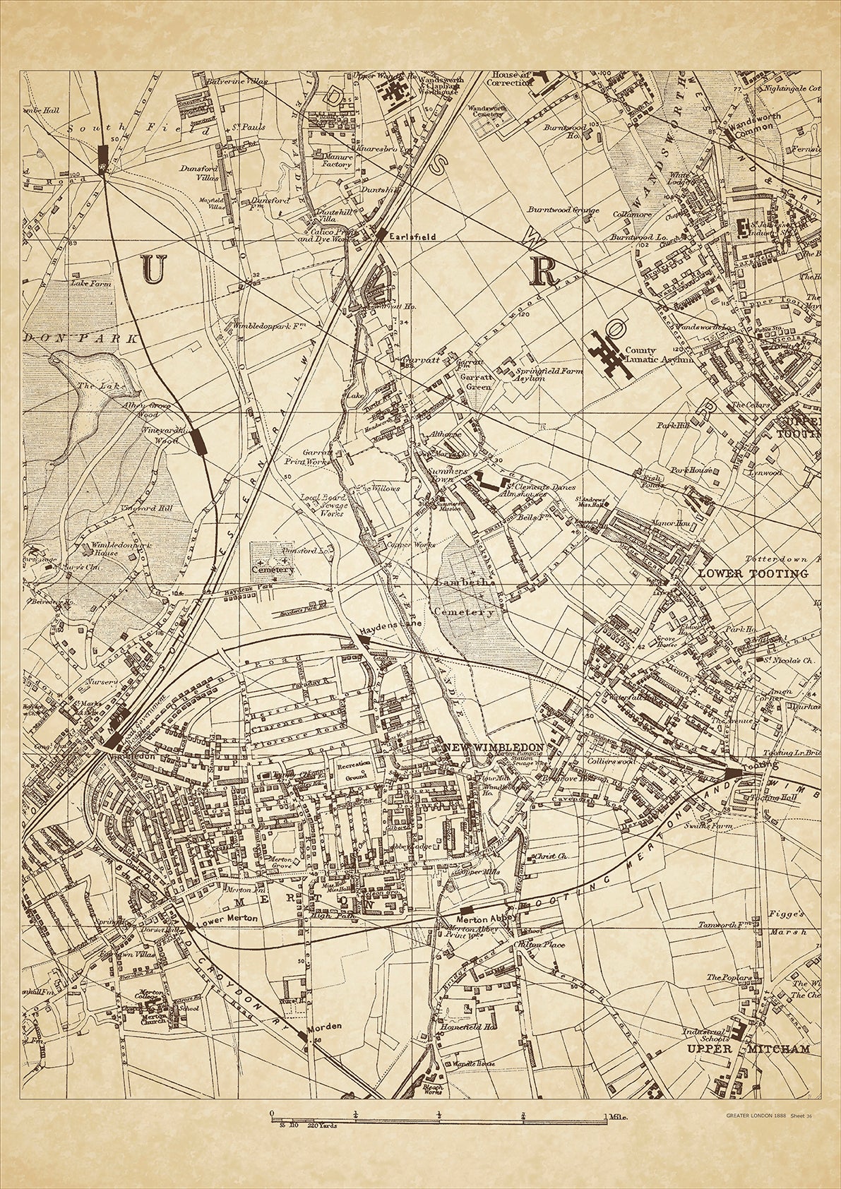
Greater London in 1888 Series - showing Wimbledon (east), Merton, Tooting (west), Summers Town, Wandsworth Common, Upper Mitcham - sheet 36
Greater London in 1888 Series - showing Wimbledon (east), Merton, Tooting (west), Summers Town, Wandsworth Common, Upper Mitcham - sheet 36
Couldn't load pickup availability
This digital download is a high-quality 300dpi JPG image of a London street atlas map dated 1888. It is enlarged, and sized to print if required at A2 dimensions (59.4 cm x 42 cm), or simply view it in close up on your computer screen using for instance Windows Photo or similar.
These maps are sharp and clear. All railway lines and stations are shown and named.
Wimbledon, Merton, and Tooting were all located in the south-west of London in 1888. Wimbledon was known for its large commons, which were popular for outdoor activities such as cricket and tennis. The All England Lawn Tennis and Croquet Club was founded in Wimbledon in 1868 and held its first championships in 1877, which eventually became the Wimbledon Tennis Tournament. Merton was a rural area with a few notable landmarks such as Merton Priory, which was founded in the 12th century, and Merton Place, which was a country house that belonged to Lord Nelson. Tooting was a working-class area with a mix of residential and industrial buildings, including the Tooting Bec Lido which was built in 1906. The population in these areas was primarily made up of the working class, including laborers, tradespeople, and domestic servants. There were also some wealthier residents who owned large houses or estates in the area.
Whether you're a history buff, a cartography enthusiast, or simply looking for a unique piece of decor for your home or office, this map is sure to delight. It's a piece of history that you can own and enjoy for years to come.