Elite Wall Decor
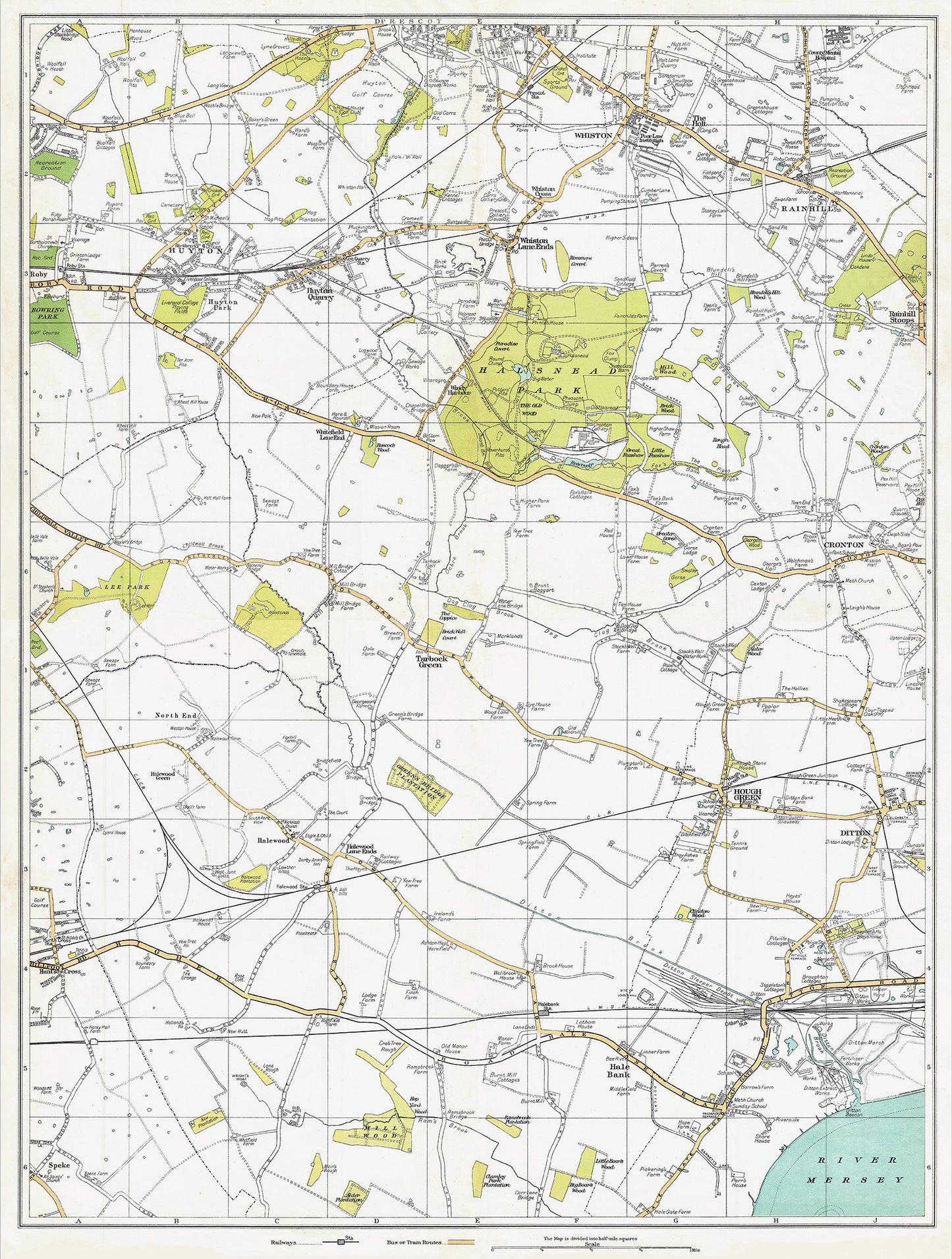
Lancashire (south) 1934 Series - Huyton, Hale Bank, Tarbock Green, Halsnead Park, Whiston, Prescot (south), Rainhill, Cronton, Hough Green, Ditton area - sheet 39
Lancashire (south) 1934 Series - Huyton, Hale Bank, Tarbock Green, Halsnead Park, Whiston, Prescot (south), Rainhill, Cronton, Hough Green, Ditton area - sheet 39
Couldn't load pickup availability
This digital download is a high-quality 300dpi JPG image of a 4 inch to the mile scale atlas map dated 1934. It is enlarged, and sized to print if required at approx A1 dimensions (84.1 x 59.4 cm), making it perfect for framing or use in a project. Or simply view it in close up on your computer screen using image software, Windows Photo or similar.
These maps give the names of roads, farms, collieries, poor law institutions, railways and stations, parks, recreation grounds, football & cricket grounds, reservoirs, viaducts, aqueducts, etc.
Footpaths are also clearly marked.
Rural buildings including farms and cottages are shown.
FOR PRINTED MAPS, CLICK HERE (EBAY): https://www.ebay.co.uk/str/wealdenrelics