Elite Wall Decor
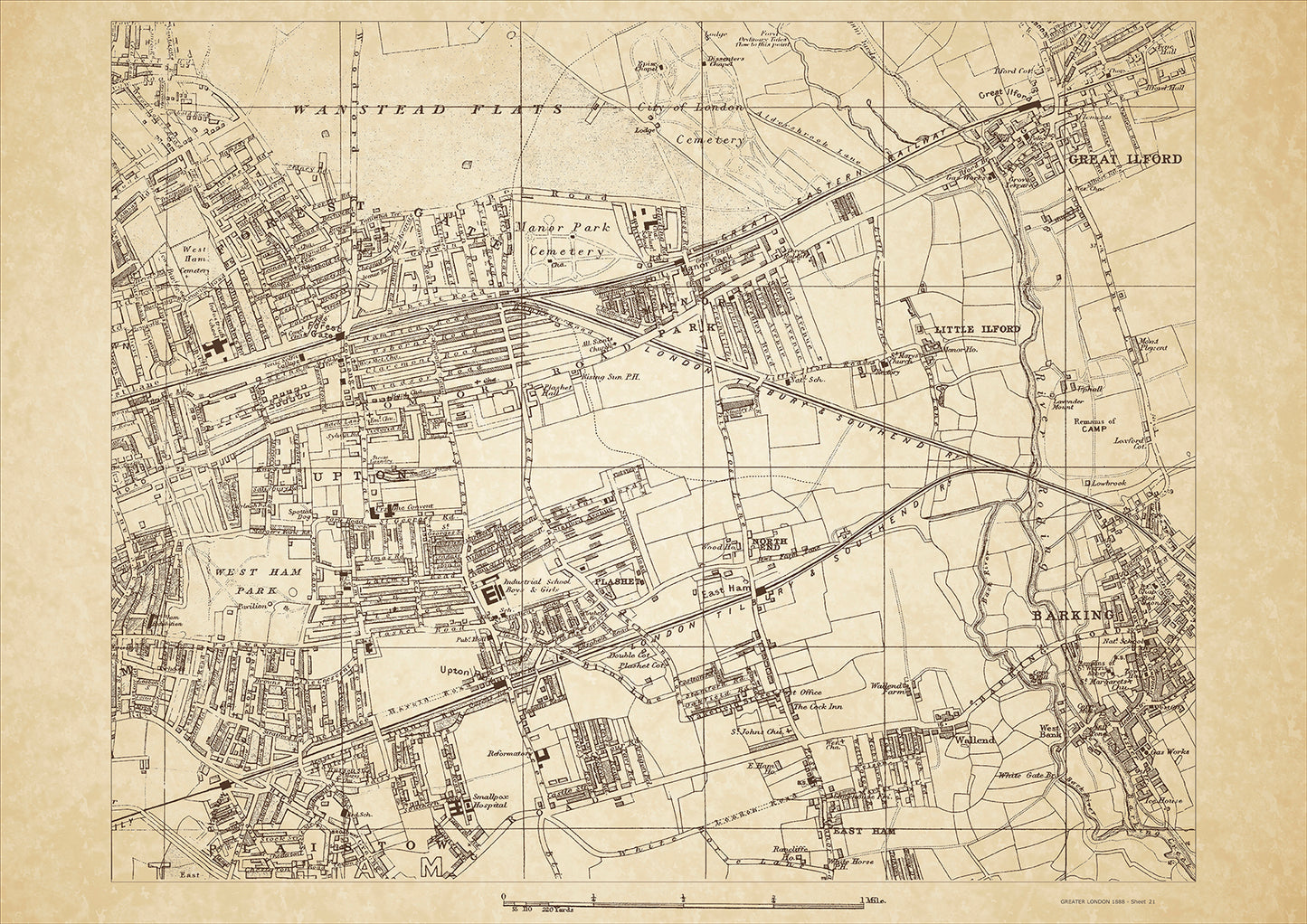
Greater London in 1888 Series - showing Barking, Ilford, Forest Gate, Upton, East Ham, Plaistow (north), West Ham Park - sheet 21
Greater London in 1888 Series - showing Barking, Ilford, Forest Gate, Upton, East Ham, Plaistow (north), West Ham Park - sheet 21
Couldn't load pickup availability
This digital download is a high-quality 300dpi JPG image of a London street atlas map dated 1888. It is enlarged, and sized to print if required at A2 dimensions (59.4 cm x 42 cm), or simply view it in close up on your computer screen using for instance Windows Photo or similar.
These maps are sharp and clear. All railway lines and stations are shown and named.
In 1888, Barking, Ilford, and Forest Gate were three suburban areas located to the east of London. The area was known for its agricultural land, and the River Roding flowed through the region, providing a source of irrigation for the farmlands.
Barking was a bustling town with a growing population due to the expansion of the railway line. The Great Eastern Railway had a station in the town, making it an important transportation hub. Barking Creek was also an important shipping canal, connecting the town to the Thames River and providing access to London's docks.
Ilford was a small town with a significant history. The area was known for its beautiful parks, including Valentines Park and Seven Kings Park. The High Road was the main shopping district, and the town was home to several churches and a few schools. The population of Ilford was predominantly middle-class, with many residents working in the nearby City of London.
Forest Gate was an up-and-coming area in 1888, known for its beautiful green spaces, including Wanstead Flats and the Forest Gate Recreation Grounds. The town was also home to several prominent schools and was considered a desirable place to live for those seeking a quieter life outside of the city.
The population of Barking, Ilford, and Forest Gate was predominantly working-class, with many residents employed in agriculture, industry, and transportation. As the railway line expanded, the population of the area continued to grow, and the towns became increasingly diverse.
Whether you're a history buff, a cartography enthusiast, or simply looking for a unique piece of decor for your home or office, this map is sure to delight. It's a piece of history that you can own and enjoy for years to come.