Elite Wall Decor
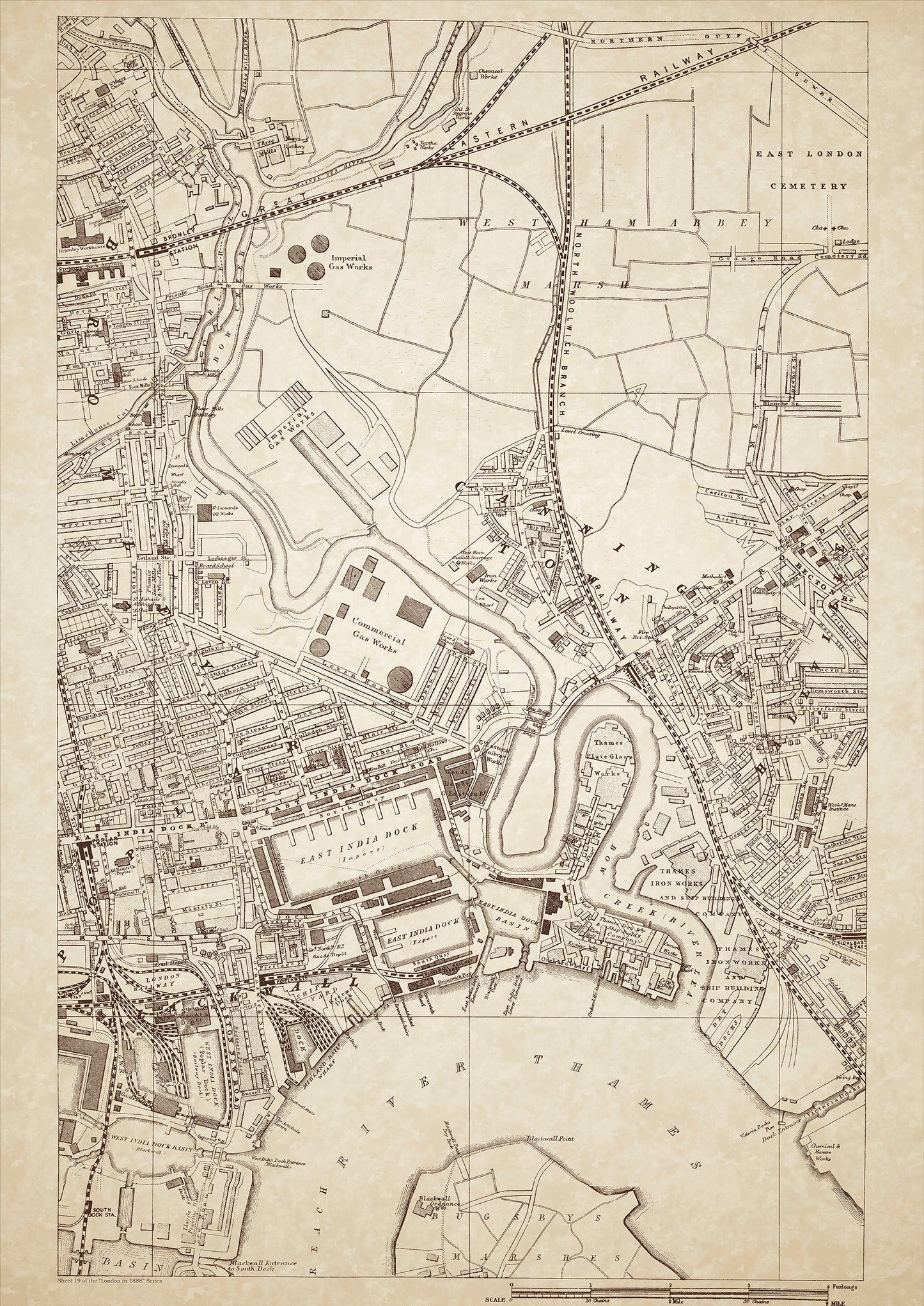
London in 1888 Series - showing Canning Town, East India Docks, Poplar, Blackwall - sheet 19
London in 1888 Series - showing Canning Town, East India Docks, Poplar, Blackwall - sheet 19
Couldn't load pickup availability
Also shows: Bromley Workhouse, Stepney Sick Asylum, Bromley Station, West Ham Abbey Marsh, East London Cemetery, Imperial Gas Works buildings, Thames Iron Works & Ship Building Company, Blackwall Railway Terminus, West India Dock (Poplar Dock), West India Dock, Basin (Blackwall), East India Dock (Import), East India Dock (Export), East india Dock Basin.
This digital download is a high-quality 300dpi JPG image of a London street atlas map dated 1888. It is enlarged, and sized to print if required at A1 dimensions (84.1 cm x 59.4 cm), or simply view it in close up on your computer screen using for instance Windows Photo or similar. These maps are sharp and clear. All railway lines and stations are shown and named.
Canning Town, located in the East End of London in 1888, was an industrial area known for its docks, gas works, and shipbuilding industry. The class of people living in this area were mainly working-class, laborers, and factory workers. East India Docks and West India Docks were the two main docks in the area, and they were used for importing and exporting goods, which brought in many jobs for the local population.
Poplar and Blackwall were also important industrial areas, with factories and warehouses lining the streets. The Bromley Workhouse and Stepney Sick Asylum provided healthcare for the local population, while the East London Cemetery was the final resting place for many of the area's residents.
The Imperial Gas Works buildings and the Thames Iron Works & Ship Building Company were important landmarks in the area. The Blackwall Railway Terminus connected the area to the rest of London, while the West India Dock (Poplar Dock), West India Dock Basin (Blackwall), East India Dock (Import), and East India Dock Basin (Export) were all important ports for shipping goods.
The class of people living in this area were mainly working-class, laborers, and factory workers. The living conditions were often cramped and unsanitary, and poverty was rampant. Despite these challenges, the people of Canning Town, Poplar, Blackwall, and the surrounding areas worked hard to make a living and provide for their families.
Whether you're a history buff, a cartography enthusiast, or simply looking for a unique piece of decor for your home or office, this map is sure to delight. It's a piece of history that you can own and enjoy for years to come.

