Elite Wall Decor
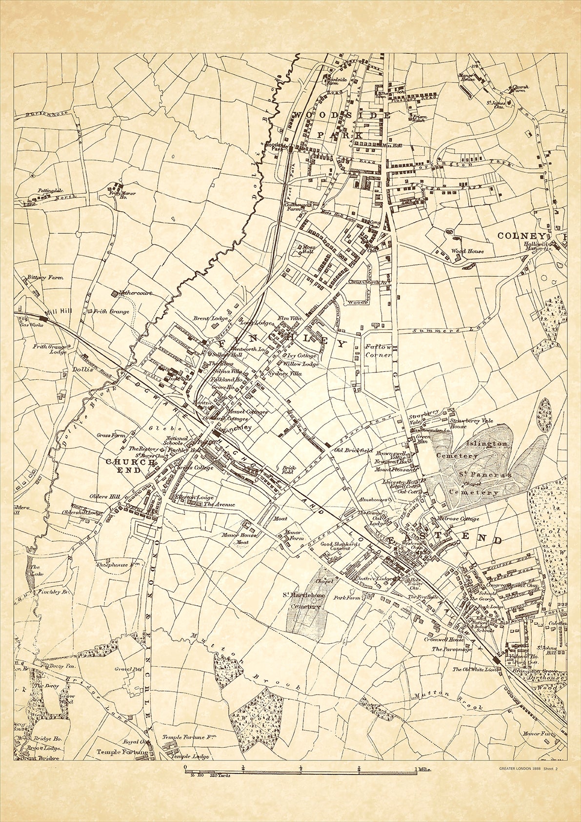
Greater London in 1888 Series - showing Finchley, Woodside Park, Colney Hatch (west), East End, Church End - sheet 2
Greater London in 1888 Series - showing Finchley, Woodside Park, Colney Hatch (west), East End, Church End - sheet 2
Couldn't load pickup availability
This digital download is a high-quality 300dpi JPG image of a London street atlas map dated 1888. It is enlarged, and sized to print if required at A2 dimensions (59.4 cm x 42 cm), or simply view it in close up on your computer screen using for instance Windows Photo or similar.
These maps are sharp and clear. All railway lines and stations are shown and named.
Finchley and Woodside Park are located in the northern part of London. In 1888, these areas were relatively rural compared to the rest of London. They were home to wealthy families who owned large houses and estates.
The main road that ran through Finchley was the Great North Road, which connected London to the north of England. One of the historical places of interest in Finchley is Avenue House, which was built in 1859 and was once the home of Henry Charles Stephens, a wealthy ink manufacturer.
Woodside Park was known for its grand mansions and large gardens. The area was also home to Woodside Park Synagogue, which was founded in 1897 and is still in use today. The class of people that lived in Finchley and Woodside Park in 1888 were mostly affluent and well-educated.
Whether you're a history buff, a cartography enthusiast, or simply looking for a unique piece of decor for your home or office, this map is sure to delight. It's a piece of history that you can own and enjoy for years to come.