Elite Wall Decor
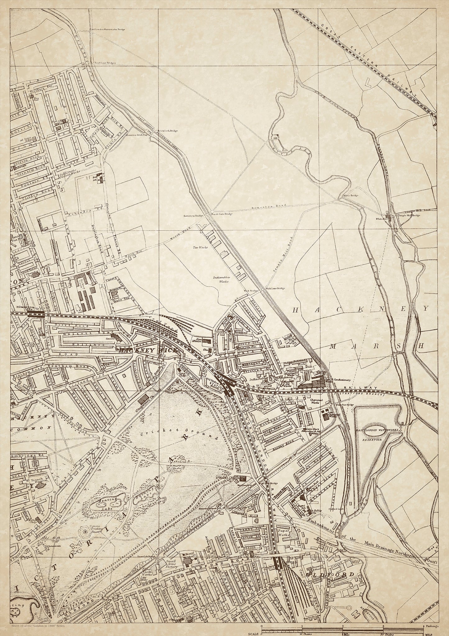
London in 1888 Series - showing Hackney Marsh, Hackney Wick, Oldford - sheet 10
London in 1888 Series - showing Hackney Marsh, Hackney Wick, Oldford - sheet 10
Couldn't load pickup availability
Also shows: Glyn Road, the White Hart by Temple Mill Bridge, Victoria Park, Oldford Road, Victoria Park Station, Oldford Station.
This digital download is a high-quality 300dpi JPG image of a London street atlas map dated 1888. It is enlarged, and sized to print if required at A1 dimensions (84.1 cm x 59.4 cm), or simply view it in close up on your computer screen using for instance Windows Photo or similar. These maps are sharp and clear. All railway lines and stations are shown and named.
Hackney Marsh, Hackney Wick, and Oldford were areas in East London that were predominantly working-class during the late 19th century. These areas were heavily industrialized with factories, mills, and warehouses, making it a hub for the manufacturing industry. Hackney Wick was particularly known for its thriving textile industry, while Oldford was home to a number of breweries.
The White Hart by Temple Mill Bridge was a popular pub located on the River Lea in Oldford, known for its picturesque location and lively atmosphere.
Victoria Park, located in the vicinity of Oldford Road, was a large public park built in the 1840s. It was a popular recreational spot for the working-class residents of the area, offering green spaces, lakes, and a boating lake.
The nearby Victoria Park Station and Oldford Station provided easy access to the rest of London, and were particularly popular with commuters and those travelling to work.
Whether you're a history buff, a cartography enthusiast, or simply looking for a unique piece of decor for your home or office, this map is sure to delight. It's a piece of history that you can own and enjoy for years to come.