Elite Wall Decor
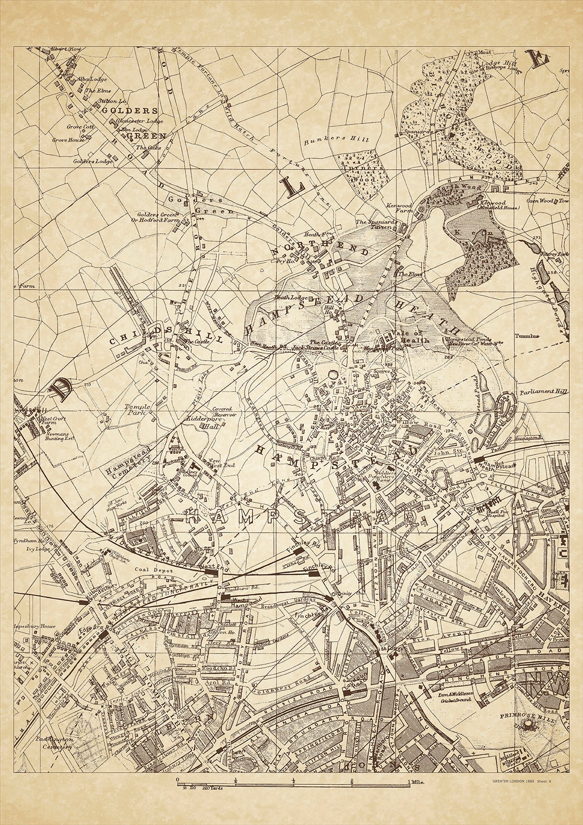
Greater London in 1888 Series - showing Hampstead, Golders Green, Kilburn (north), Northend, Childs Hill - sheet 8
Greater London in 1888 Series - showing Hampstead, Golders Green, Kilburn (north), Northend, Childs Hill - sheet 8
Couldn't load pickup availability
This digital download is a high-quality 300dpi JPG image of a London street atlas map dated 1888. It is enlarged, and sized to print if required at A2 dimensions (59.4 cm x 42 cm), or simply view it in close up on your computer screen using for instance Windows Photo or similar.
These maps are sharp and clear. All railway lines and stations are shown and named.
In 1888, Hampstead, Golders Green, and Kilburn were rapidly growing neighborhoods on the outskirts of London. Hampstead, known for its beautiful heath, was home to many artists and writers, including John Keats and Robert Louis Stevenson. Kilburn was a bustling commercial center, with a variety of shops, theaters, and restaurants catering to a diverse population. Golders Green, once a rural village, was becoming more developed with the arrival of the railway.
The residents of these areas were mostly middle class, including merchants, shopkeepers, and professionals such as doctors and lawyers. Many families were moving to these neighborhoods to escape the overcrowding and pollution of central London.
Historical places of interest in the area include the Hampstead Heath, a large park and nature reserve, the Kilburn Gaumont State Cinema, which opened in 1937 as one of the largest and most opulent cinemas in Europe, and the Golders Green Crematorium, established in 1902 as one of the first crematoria in the country. The Kilburn High Road and West End Lane in Hampstead are also known for their historic architecture, including Victorian terraced houses and Art Deco buildings.
Whether you're a history buff, a cartography enthusiast, or simply looking for a unique piece of decor for your home or office, this map is sure to delight. It's a piece of history that you can own and enjoy for years to come.

