Elite Wall Decor
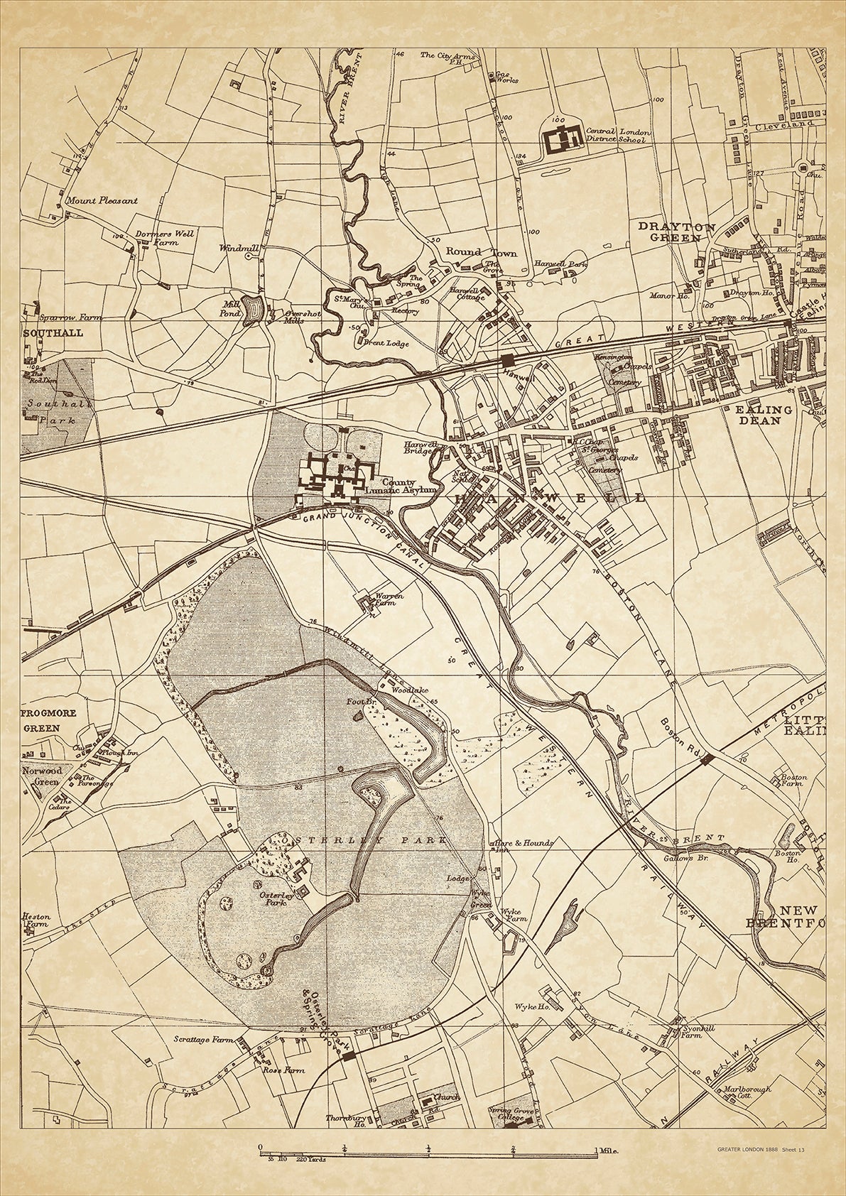
Greater London in 1888 Series - showing Hanwell, Osterley Park, Drayton Green, Ealing Dean - sheet 13
Greater London in 1888 Series - showing Hanwell, Osterley Park, Drayton Green, Ealing Dean - sheet 13
Couldn't load pickup availability
This digital download is a high-quality 300dpi JPG image of a London street atlas map dated 1888. It is enlarged, and sized to print if required at A2 dimensions (59.4 cm x 42 cm), or simply view it in close up on your computer screen using for instance Windows Photo or similar.
These maps are sharp and clear. All railway lines and stations are shown and named.
Hanwell and Osterley were both suburban areas located in the west of London in 1888. Hanwell was known for its Hanwell Lunatic Asylum, which was one of the largest in Europe at the time, and for its grand Hanwell Viaduct which was a prominent landmark. Osterley, on the other hand, was known for its stately Osterley Park which was owned by the Jersey family, and for its impressive Osterley Station which was designed by the famous architect Isambard Kingdom Brunel.
In terms of the class of people that lived in Hanwell and Osterley in 1888, both areas were considered middle-class suburbs with a mix of affluent residents and tradespeople. The Hanwell Lunatic Asylum provided employment for many in the area, including doctors, nurses, and administrators. Osterley, on the other hand, was home to wealthy families who enjoyed the peaceful surroundings and rural charm of the area. The railway connection also allowed for easy commuting to central London, making it an attractive location for those who worked in the city.
Whether you're a history buff, a cartography enthusiast, or simply looking for a unique piece of decor for your home or office, this map is sure to delight. It's a piece of history that you can own and enjoy for years to come.