Elite Wall Decor
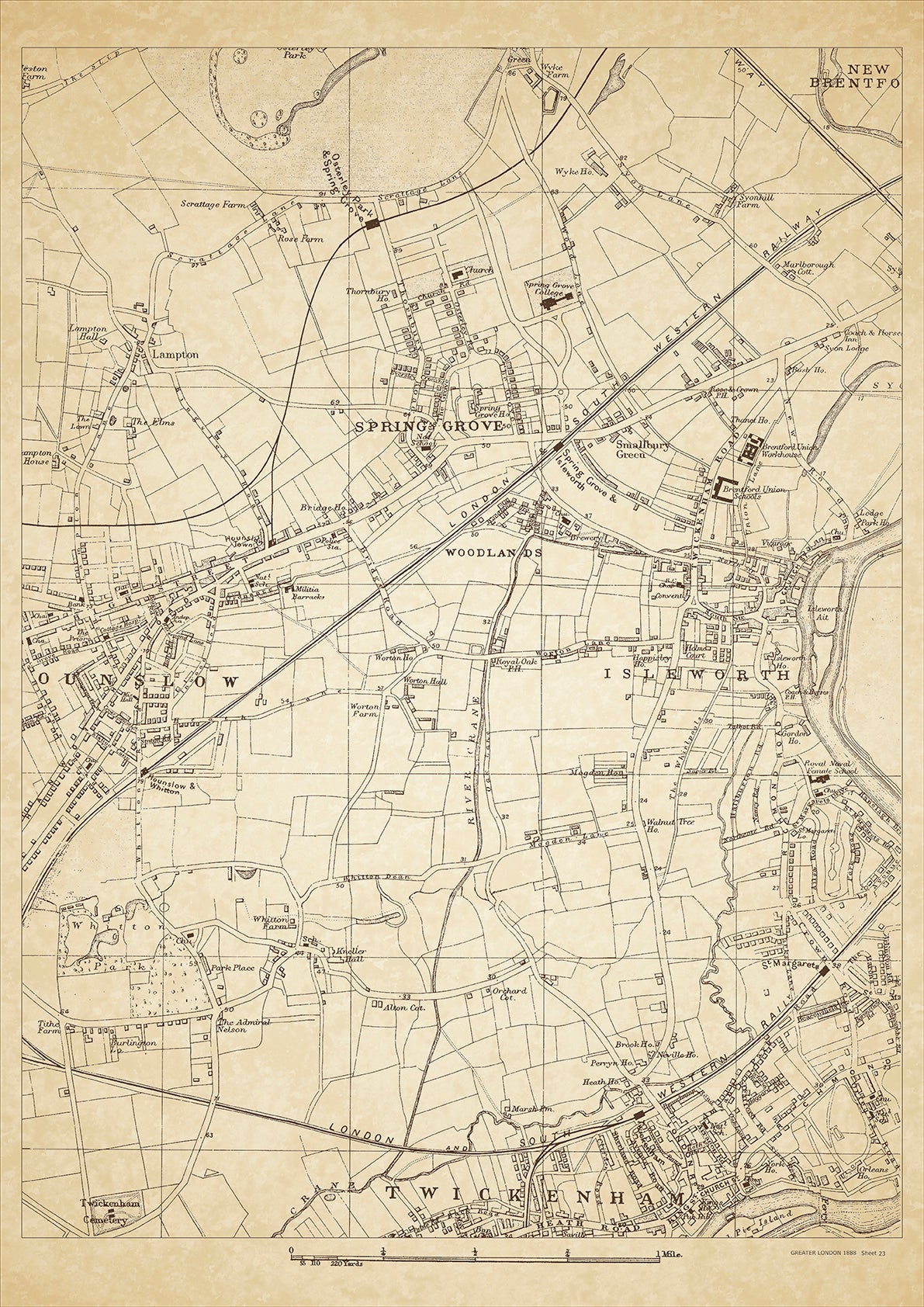
Greater London in 1888 Series - showing Isleworth, Hounslow, Spring Grove, Twickenham (north) - sheet 23
Greater London in 1888 Series - showing Isleworth, Hounslow, Spring Grove, Twickenham (north) - sheet 23
Couldn't load pickup availability
This digital download is a high-quality 300dpi JPG image of a London street atlas map dated 1888. It is enlarged, and sized to print if required at A2 dimensions (59.4 cm x 42 cm), or simply view it in close up on your computer screen using for instance Windows Photo or similar.
These maps are sharp and clear. All railway lines and stations are shown and named.
Isleworth, Hounslow, and Spring Grove were small towns located in the western part of London in 1888. Isleworth was known for its picturesque location on the banks of the River Thames and its historic buildings such as All Saints Church and Isleworth Crown Court. Hounslow, on the other hand, was a market town with a rich history dating back to the Roman era. Its famous landmarks included the Hounslow Heath and the St. Paul's Church.
Spring Grove was a small hamlet located near Isleworth and was known for its tranquil surroundings and beautiful gardens. It was home to a number of wealthy families who owned large estates and mansions in the area. The people who lived in Isleworth, Hounslow, and Spring Grove were mainly middle to upper class, with many working in professions such as law, medicine, and finance. The towns were well-connected to London by road and rail, making them popular residential areas for wealthy Londoners looking to escape the hustle and bustle of the city.
Whether you're a history buff, a cartography enthusiast, or simply looking for a unique piece of decor for your home or office, this map is sure to delight. It's a piece of history that you can own and enjoy for years to come.