Elite Wall Decor
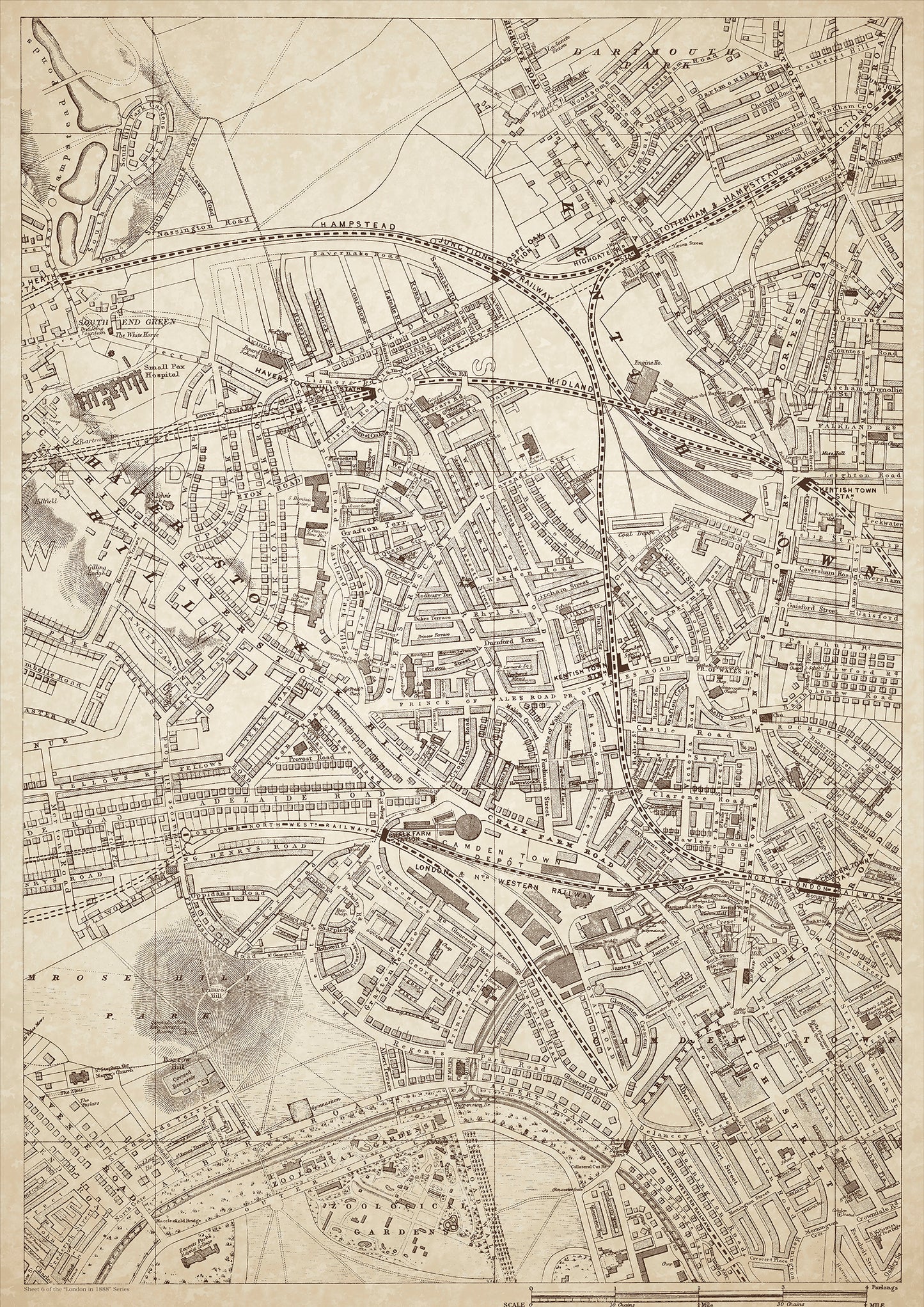
London in 1888 Series - showing Kentish Town, Haverstock Hill, Primrose Hill, Camden Town - sheet 6
London in 1888 Series - showing Kentish Town, Haverstock Hill, Primrose Hill, Camden Town - sheet 6
Couldn't load pickup availability
Also shows: South End Green, Dartmouth Park, Gospel Oak Station, Highgate Road Station, Haverstock Hill Station, Kentish Town Station, Junction Road Station, Kentish Town Station, Camden Town Station, Chalk Farm Station, Regents Park Zoo.
This digital download is a high-quality 300dpi JPG image of a London street atlas map dated 1888. It is enlarged, and sized to print if required at A1 dimensions (84.1 cm x 59.4 cm), or simply view it in close up on your computer screen using for instance Windows Photo or similar. These maps are sharp and clear. All railway lines and stations are shown and named.
In 1888, the areas of Kentish Town, Haverstock Hill, Primrose Hill, Camden Town, and surrounding areas were predominantly working-class neighborhoods, with some middle-class residents as well. The population was largely made up of factory workers, tradesmen, and laborers.
Kentish Town was a bustling commercial district, with numerous shops, pubs, and businesses. Haverstock Hill, with its steep gradient, was an upmarket residential area, home to some of the wealthier inhabitants of the district. Primrose Hill, with its picturesque views over London, was a popular spot for walks and picnics.
Camden Town was a busy commercial and residential area, with a diverse population of workers and immigrants. The area had a reputation for being somewhat rough and lawless, with a number of notorious pubs and drinking establishments.
South End Green and Dartmouth Park were quieter residential areas, with a mix of middle-class and working-class residents. Gospel Oak Station, Highgate Road Station, Haverstock Hill Station, Kentish Town Station, Junction Road Station, and Chalk Farm Station all served the area, providing transportation links to other parts of London.
Notable landmarks and places of interest in the area included Regents Park Zoo, which had opened in 1828 and was home to a wide range of animals from around the world. The area was also home to a number of historic pubs, such as The Flask in Highgate, which dates back to the 17th century, and The World's End in Camden Town, which was a popular haunt for artists and writers.
Whether you're a history buff, a cartography enthusiast, or simply looking for a unique piece of decor for your home or office, this map is sure to delight. It's a piece of history that you can own and enjoy for years to come.