Elite Wall Decor
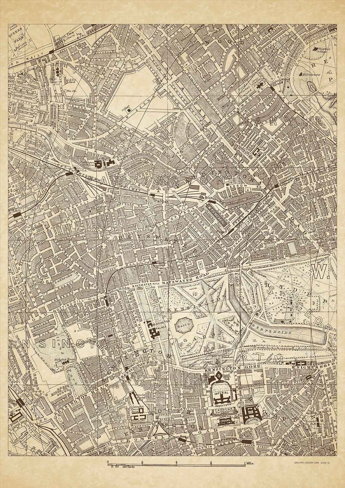
Greater London in 1888 Series - showing Paddington, Bayswater, Kensington, Cromwell Road, Kensington Gore, Notting Hill, Maida Vale, Edgware Road - sheet 16
Greater London in 1888 Series - showing Paddington, Bayswater, Kensington, Cromwell Road, Kensington Gore, Notting Hill, Maida Vale, Edgware Road - sheet 16
Couldn't load pickup availability
This digital download is a high-quality 300dpi JPG image of a London street atlas map dated 1888. It is enlarged, and sized to print if required at A2 dimensions (59.4 cm x 42 cm), or simply view it in close up on your computer screen using for instance Windows Photo or similar.
These maps are sharp and clear. All railway lines and stations are shown and named.
In 1888, Paddington, Bayswater, and Kensington were affluent residential areas in London. Paddington had grand squares and terraces, including the popular Sussex Gardens. Bayswater had a large population of wealthy foreigners, and many grand hotels were built there. Kensington was home to many grand Victorian townhouses and mansions, including the famous Kensington Palace, the birthplace of Queen Victoria. Other places of interest included the Albert Memorial, the Natural History Museum, and the Royal Albert Hall.
The class of people that lived in these areas were primarily wealthy upper-class families, aristocrats, and foreign residents. The grandeur of the buildings and the wealth of the inhabitants reflected the prosperity of the Victorian era, and many of the buildings have been preserved to this day, making them popular tourist attractions.
Whether you're a history buff, a cartography enthusiast, or simply looking for a unique piece of decor for your home or office, this map is sure to delight. It's a piece of history that you can own and enjoy for years to come.