Elite Wall Decor
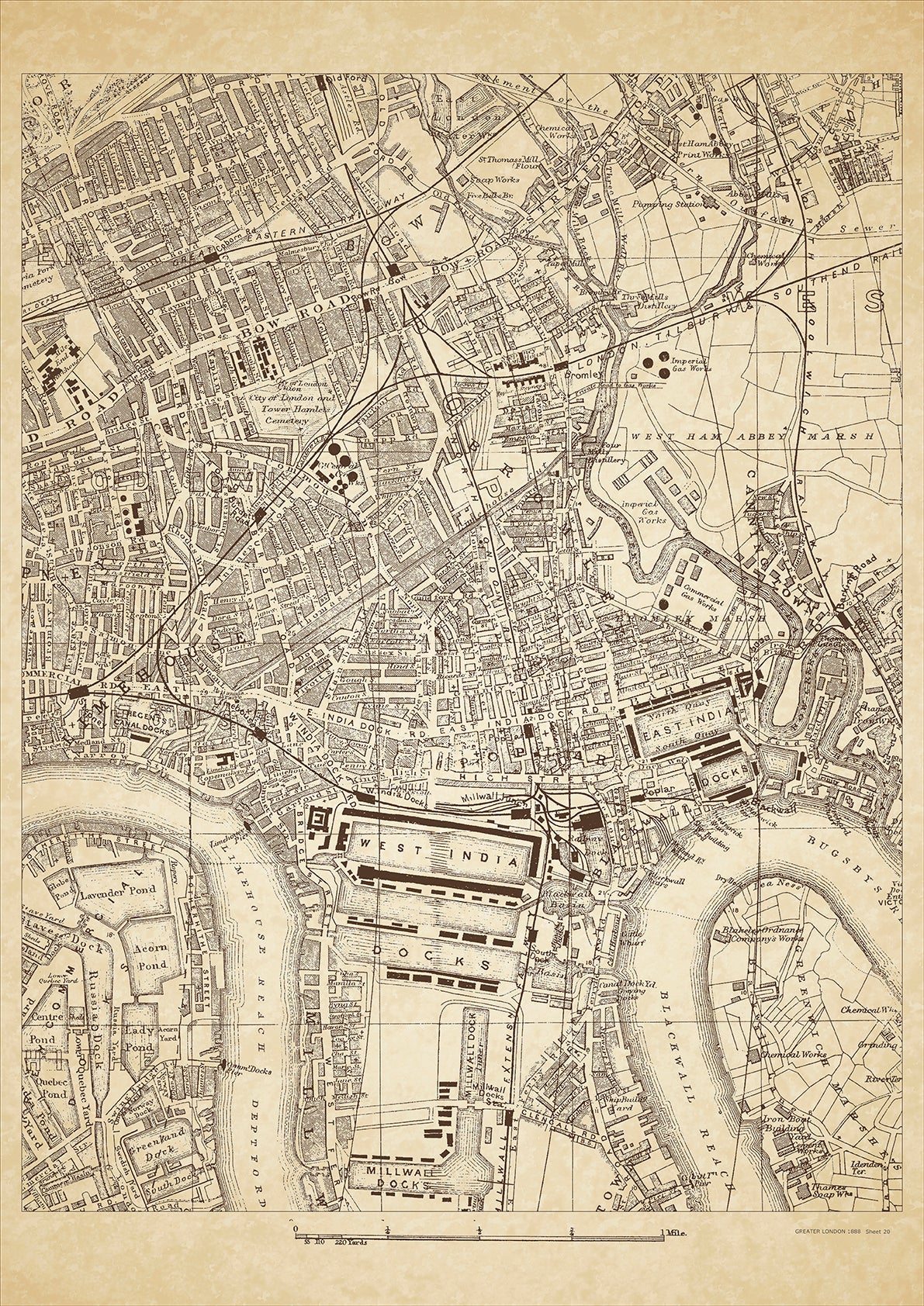
Greater London in 1888 Series - showing Poplar, Bow, Limehouse, Bromley-by-Bow, West India Docks, East India Docks, Commercial Docks, Millwall (north), Canning Town, Blackwall - sheet 20
Greater London in 1888 Series - showing Poplar, Bow, Limehouse, Bromley-by-Bow, West India Docks, East India Docks, Commercial Docks, Millwall (north), Canning Town, Blackwall - sheet 20
Couldn't load pickup availability
This digital download is a high-quality 300dpi JPG image of a London street atlas map dated 1888. It is enlarged, and sized to print if required at A2 dimensions (59.4 cm x 42 cm), or simply view it in close up on your computer screen using for instance Windows Photo or similar.
These maps are sharp and clear. All railway lines and stations are shown and named.
Poplar, Bow, and Limehouse were all located in the eastern part of London in 1888. These areas were primarily industrial and working-class, with many residents employed in manufacturing and trade.
Poplar was known for its shipyards and docks, as well as its proximity to the River Thames. The area was primarily industrial in 1888, with many factories and warehouses. The residents of Poplar were primarily working-class, with many employed in the shipbuilding and trade industries.
Bow, located in the borough of Tower Hamlets, was known for its markets and shops, as well as its proximity to the River Lea. The area was primarily residential in 1888, with many small terraced houses and flats. The residents of Bow were primarily working-class, with many employed in manufacturing and trade.
Limehouse, also located in the borough of Tower Hamlets, was known for its shipyards and docks, as well as its bustling markets and shops. The area was primarily industrial and working-class in 1888, with many factories and warehouses. The residents of Limehouse were primarily working-class, with many employed in the shipbuilding and trade industries.
Today, visitors to Poplar, Bow, and Limehouse can still see many historic landmarks and buildings from this era. These areas have also undergone significant changes and development in the years since 1888, with many former industrial areas being redeveloped for residential and commercial use. Limehouse is now known for its trendy bars and restaurants, while Poplar and Bow remain primarily residential areas with a strong working-class heritage.
Whether you're a history buff, a cartography enthusiast, or simply looking for a unique piece of decor for your home or office, this map is sure to delight. It's a piece of history that you can own and enjoy for years to come.