Elite Wall Decor
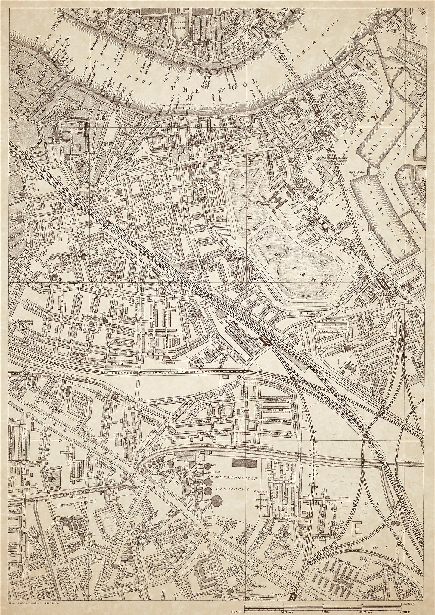
London in 1888 Series - showing Rotherhithe, Wapping, Old Kent Road - sheet 25
London in 1888 Series - showing Rotherhithe, Wapping, Old Kent Road - sheet 25
Couldn't load pickup availability
Also shows: Southwark Park, St. Olave's Union Infirmary, Albion Dock & Canada Dock, Deptford Station, Peak Frean & Co. Biscuit Manufactory, South Bermondsey Station, Deptford Hospital, Licensed Victuallers Asylum.
This digital download is a high-quality 300dpi JPG image of a London street atlas map dated 1888. It is enlarged, and sized to print if required at A1 dimensions (84.1 cm x 59.4 cm), or simply view it in close up on your computer screen using for instance Windows Photo or similar. These maps are sharp and clear. All railway lines and stations are shown and named.
Rotherhithe and Wapping were historically important districts in the east of London, situated on the banks of the Thames. The areas were important hubs for shipping and maritime trade and were home to a mix of working-class and middle-class people.
In Rotherhithe, the Albion Dock and Canada Dock were significant landmarks, while Wapping was home to the Deptford Station and the Peak Frean & Co. Biscuit Manufactory. The Old Kent Road, which runs through both areas, was a major thoroughfare connecting London with the south of England.
Southwark Park was a popular leisure destination for people in the area, while the St. Olave's Union Infirmary and Deptford Hospital provided medical care to the local community. The Licensed Victuallers Asylum, located in nearby nearby Peckham, was a charitable institution that supported retired members of the licensed trade.
Whether you're a history buff, a cartography enthusiast, or simply looking for a unique piece of decor for your home or office, this map is sure to delight. It's a piece of history that you can own and enjoy for years to come.