Elite Wall Decor
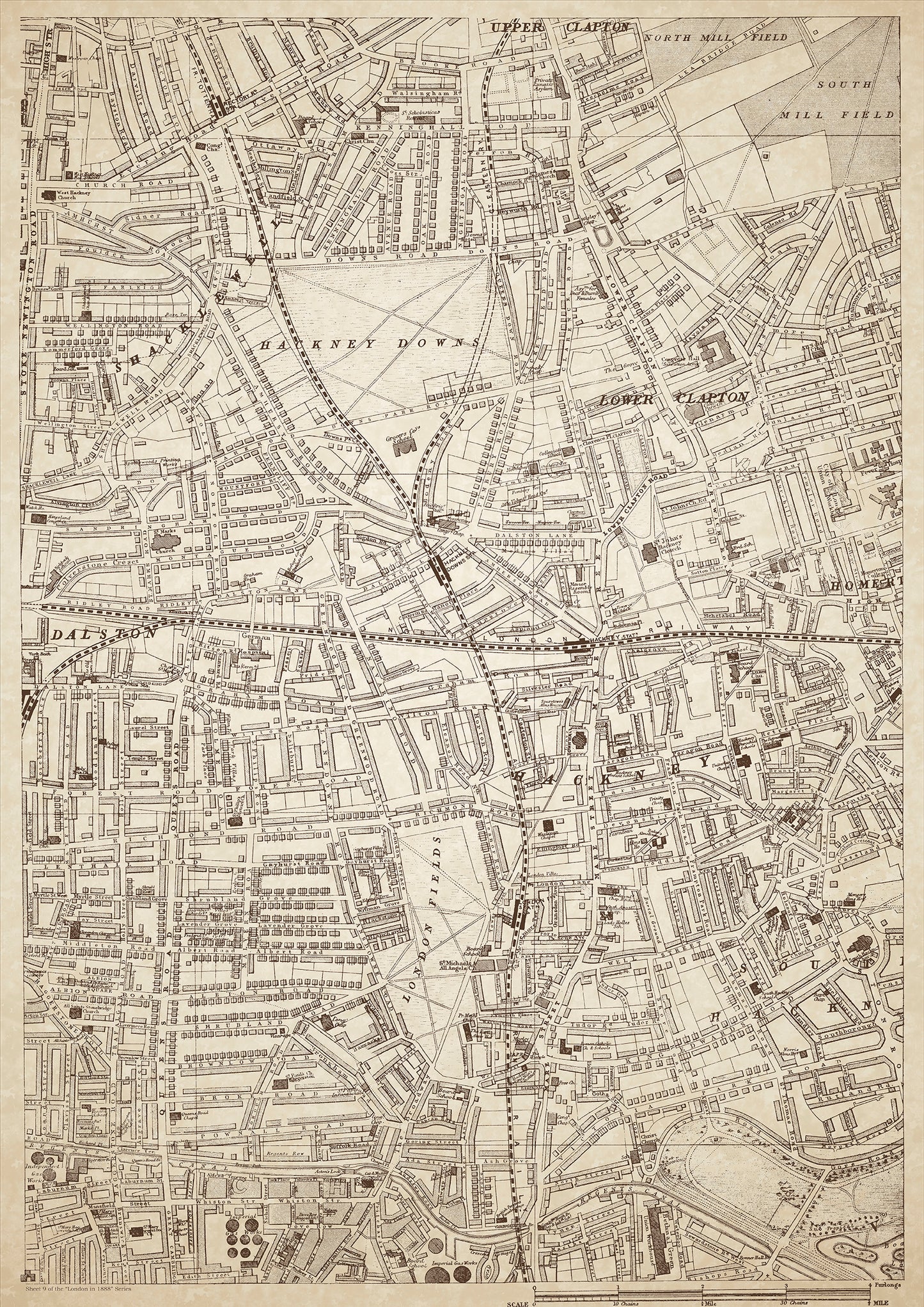
London in 1888 Series - showing Shacklewell, Clapton, Hackney - sheet 9
London in 1888 Series - showing Shacklewell, Clapton, Hackney - sheet 9
Couldn't load pickup availability
Also shows: Hackney Downs, Rectory Road Station, Hackney Downs Station, Hackney Station, London Fields, Mare Street, Queens Road, Bethnal Green Union Workhouse.
This digital download is a high-quality 300dpi JPG image of a London street atlas map dated 1888. It is enlarged, and sized to print if required at A1 dimensions (84.1 cm x 59.4 cm), or simply view it in close up on your computer screen using for instance Windows Photo or similar. These maps are sharp and clear. All railway lines and stations are shown and named.
Shacklewell, Clapton, and Hackney were located in the east of London in 1888. The areas were densely populated and had a mix of working-class and middle-class residents. Shacklewell was a small district of Hackney, and Clapton was located to the north of Hackney.
Hackney Downs was an open space located in Hackney, where locals could enjoy picnics and outdoor activities. Rectory Road Station, Hackney Downs Station, and Hackney Station were the main railway stations serving the area.
London Fields was a popular park in Hackney, where people could relax and play sports. Mare Street was the main street in the area, lined with shops and businesses.
Queens Road was another important street, connecting Hackney to Bethnal Green. The Bethnal Green Union Workhouse was located in the area, providing housing and support for the poor and needy.
Whether you're a history buff, a cartography enthusiast, or simply looking for a unique piece of decor for your home or office, this map is sure to delight. It's a piece of history that you can own and enjoy for years to come.