Elite Wall Decor
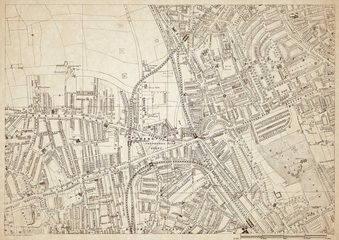
London in 1888 Series - showing Shepherds Bush, Notting Hill - sheet 20
London in 1888 Series - showing Shepherds Bush, Notting Hill - sheet 20
Couldn't load pickup availability
Also shows: Wormholt Farm, Old Oak Farm, Woodlane Farm, Gynam Farm, Uxbridge Road, Goldhawk Road, Holland Park, Ladbroke Grove, Addison Road.
This digital download is a high-quality 300dpi JPG image of a London street atlas map dated 1888. It is enlarged, and sized to print if required at A1 dimensions (84.1 cm x 59.4 cm), or simply view it in close up on your computer screen using for instance Windows Photo or similar. These maps are sharp and clear. All railway lines and stations are shown and named.
In 1888, Shepherds Bush, Notting Hill, and the surrounding areas were primarily residential and agricultural areas with a mix of working-class and upper-class residents. The area was characterized by large estates and farms, with many of the houses belonging to wealthy merchants and businessmen.
One of the most notable areas in the region was Holland Park, a large park and public garden that was opened to the public in 1952. The park was previously owned by the wealthy Holland family and was known for its beautiful gardens and grand mansion.
Other areas of interest included Ladbroke Grove, a residential street lined with grand Victorian townhouses, and Addison Road, which was home to several large mansions and the Addison Road Station.
Several farms, such as Wormholt Farm, Old Oak Farm, Woodlane Farm, and Gynam Farm, dotted the landscape and provided fresh produce for the growing city of London.
Whether you're a history buff, a cartography enthusiast, or simply looking for a unique piece of decor for your home or office, this map is sure to delight. It's a piece of history that you can own and enjoy for years to come.