Elite Wall Decor
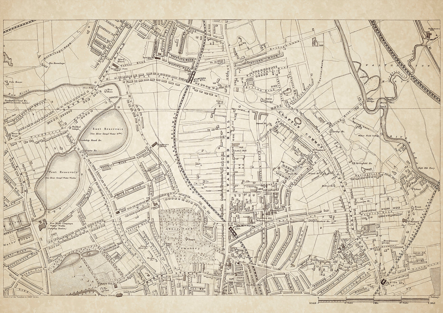
London in 1888 Series - showing Stamford Hill, Clapton Common - sheet 3
London in 1888 Series - showing Stamford Hill, Clapton Common - sheet 3
Couldn't load pickup availability
Also shows: Stamford Hill Station, New River Company Water Works East & West Reservoirs, Seven Sisters Road (part of), Abney Park Cemetery, Stoke Newington Station, Clapton Station, Stoke Newington Common (north), Upper Clapton Road, Walthamstow Marsh
This digital download is a high-quality 300dpi JPG image of a London street atlas map dated 1888. It is enlarged, and sized to print if required at A1 dimensions (84.1 cm x 59.4 cm), or simply view it in close up on your computer screen using for instance Windows Photo or similar. These maps are sharp and clear. All railway lines and stations are shown and named.
In the late 19th century, the areas of Stamford Hill, Clapton Common, and Upper Clapton in London were largely middle to upper-class residential neighborhoods with a growing population of Jewish immigrants. Stamford Hill was especially known for its large Orthodox Jewish community. The area boasted several impressive Victorian homes, such as the Springfield Mansion on Stamford Hill, and the Grade II-listed Old School House on Clapton Common.
Stamford Hill Station, located on the Lea Valley line, was a crucial transportation hub connecting the area to other parts of London. The New River Company Water Works East & West Reservoirs provided clean water for the growing population.
Abney Park Cemetery, founded in 1840, was one of the "Magnificent Seven" cemeteries in London and was the final resting place for many notable figures, including William Booth, the founder of the Salvation Army. Stoke Newington Station, Clapton Station, and Walthamstow Marsh also served as important transport links for the area.
The Stoke Newington Common in the north of the area was a popular green space for locals to relax and play sports. The Upper Clapton Road was a main thoroughfare lined with shops, pubs, and houses. The marshes surrounding the River Lea and Walthamstow Reservoir provided grazing land for cattle and open space for recreation.
Overall, the areas of Stamford Hill, Clapton Common, and Upper Clapton in 1888 were largely prosperous residential neighborhoods with good transport links and access to green spaces. The growing Jewish population added a unique cultural flavor to the area.
Walthamstow Marsh was a large area of marshland located in the east of London, known for its diverse wildlife and stunning natural beauty. It was a popular destination for people to visit and enjoy the great outdoors.
Whether you're a history buff, a cartography enthusiast, or simply looking for a unique piece of decor for your home or office, this map is sure to delight. It's a piece of history that you can own and enjoy for years to come.