Elite Wall Decor
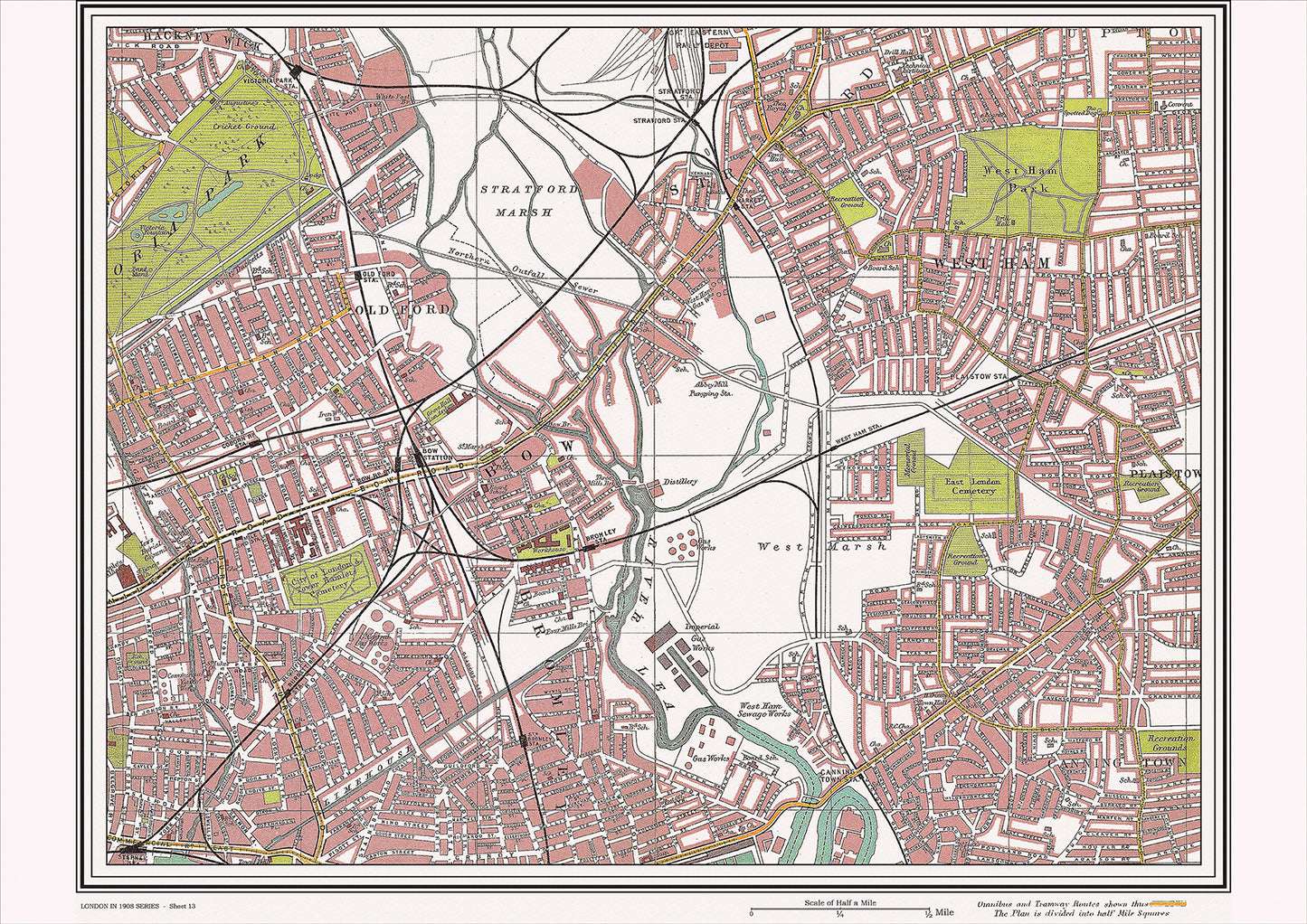
London in 1908 Series - showing Bow, West Ham area (Lon1908-13)
London in 1908 Series - showing Bow, West Ham area (Lon1908-13)
Couldn't load pickup availability
This digital download is a high-quality 300dpi JPG image of a street atlas map dated 1908. It is enlarged, and sized to print if required at A2 dimensions (59.4 cm x 42 cm), making it perfect for framing or use in a project. Or simply view it in close up on your computer screen using Windows Photo or similar.
This series of 1908 maps of London shows (where present) roads, farms, public buildings (such as hospitals, libraries, town halls, churches, schools, colleges, museums, gas works, sewage works, etc.) , larger houses, woods, rivers, estates and parks. They also show footpaths, ponds and lakes.
These maps are sharp and clear. All railway lines and stations are shown and named.
Bow and West Ham were both areas located in the east end of London in 1908. They were characterized by their industrial nature, as they were home to numerous factories and warehouses. However, these areas also had a rich cultural history and a number of notable landmarks.
One of the most famous landmarks in the area was the Bow Road Methodist Church, which had been established in the mid-19th century and was known for its impressive Gothic Revival architecture. The nearby St. Mary's Church in Bow was another notable religious landmark, dating back to the 14th century.
In West Ham, one of the most famous landmarks was the West Ham Park, which was opened to the public in the mid-19th century and was known for its beautiful gardens and green spaces. Another notable landmark was the West Ham Abbey, which was founded in the 12th century and was known for its impressive architecture and historical significance.
Transportation in the area was provided by a network of trams and buses, which connected Bow and West Ham to other parts of the city. The nearby Bromley-by-Bow tube station provided access to the London Underground, making it easy to travel to other parts of London.
Overall, Bow and West Ham in 1908 were characterized by their industrial nature and their rich cultural history. The Bow Road Methodist Church and St. Mary's Church were significant religious landmarks in the area, while West Ham Park and the West Ham Abbey added to the area's beauty and historical significance. The transportation links provided easy access to other parts of the city, making the area an important hub of commerce and activity in early 20th century London.
Whether you're a history buff, a cartography enthusiast, or simply looking for a unique piece of decor for your home or office, this map is sure to delight. It's a piece of history that you can own and enjoy for years to come.