Elite Wall Decor
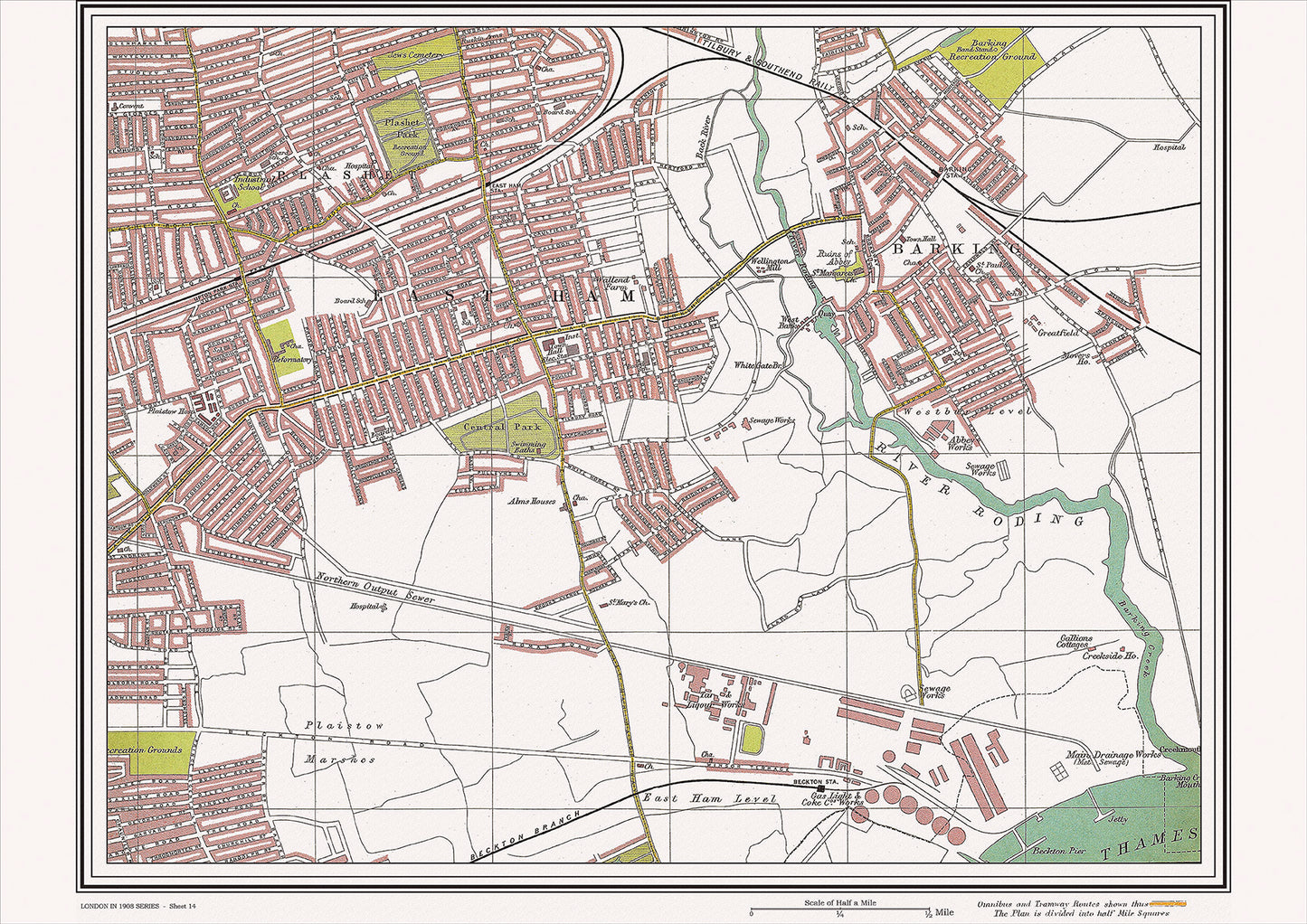
London in 1908 Series - showing East Ham, Barking area (Lon1908-14)
London in 1908 Series - showing East Ham, Barking area (Lon1908-14)
Couldn't load pickup availability
This digital download is a high-quality 300dpi JPG image of a street atlas map dated 1908. It is enlarged, and sized to print if required at A2 dimensions (59.4 cm x 42 cm), making it perfect for framing or use in a project. Or simply view it in close up on your computer screen using Windows Photo or similar.
This series of 1908 maps of London shows (where present) roads, farms, public buildings (such as hospitals, libraries, town halls, churches, schools, colleges, museums, gas works, sewage works, etc.) , larger houses, woods, rivers, estates and parks. They also show footpaths, ponds and lakes.
These maps are sharp and clear. All railway lines and stations are shown and named.
East Ham and Barking were two neighboring areas located in the east end of London in 1908. These areas were primarily residential, but they were also home to several notable landmarks and places of interest.
One of the most significant landmarks in the area was the Barking Abbey, which dated back to the 7th century and was known for its impressive architecture and historical significance. Another notable religious landmark was the East Ham Baptist Church, which had been established in the late 19th century and was known for its active congregation and community involvement.
In addition to these religious landmarks, the area was also home to several notable parks and green spaces. The Central Park in East Ham, for example, had been established in the mid-19th century and was known for its beautiful gardens and recreational facilities. Meanwhile, the Barking Park, which was opened to the public in the late 19th century, was known for its boating lake, ornamental gardens, and bandstand.
Transportation in the area was provided by a network of trams and buses, which connected East Ham and Barking to other parts of the city. The nearby Barking railway station provided access to the London Overground, making it easy to travel to other parts of London.
Overall, East Ham and Barking in 1908 were characterized by their rich cultural history and their strong community spirit. The Barking Abbey and the East Ham Baptist Church were significant religious landmarks, while the Central Park and the Barking Park added to the area's beauty and recreational opportunities. The transportation links provided easy access to other parts of the city, making the area an important hub of activity and commerce in early 20th century London.
Whether you're a history buff, a cartography enthusiast, or simply looking for a unique piece of decor for your home or office, this map is sure to delight. It's a piece of history that you can own and enjoy for years to come.