Elite Wall Decor
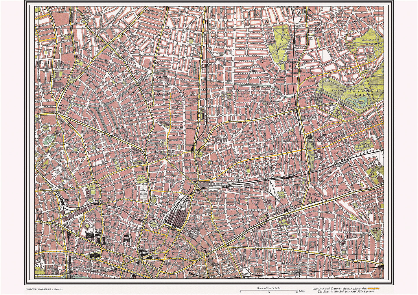
London in 1908 Series - showing Islington, Bethnal Green area (Lon1908-12)
London in 1908 Series - showing Islington, Bethnal Green area (Lon1908-12)
Couldn't load pickup availability
This digital download is a high-quality 300dpi JPG image of a street atlas map dated 1908. It is enlarged, and sized to print if required at A2 dimensions (59.4 cm x 42 cm), making it perfect for framing or use in a project. Or simply view it in close up on your computer screen using Windows Photo or similar.
This series of 1908 maps of London shows (where present) roads, farms, public buildings (such as hospitals, libraries, town halls, churches, schools, colleges, museums, gas works, sewage works, etc.) , larger houses, woods, rivers, estates and parks. They also show footpaths, ponds and lakes.
These maps are sharp and clear. All railway lines and stations are shown and named.
Islington and Bethnal Green were both important areas of London in 1908, each with their own unique history and places of interest.
Islington, located just north of the city center, was home to a number of historic landmarks and churches. One of the most famous churches in the area was St. Mary's Church, which dated back to the 12th century and was known for its beautiful stained glass windows and impressive spire. Other notable landmarks in the area included the former Sadler's Wells Theatre, which was founded in the late 17th century and was a major center for theatrical productions in London.
Bethnal Green, located in the east end of London, was known for its working-class neighborhoods and vibrant cultural scene. One of the most notable landmarks in the area was the Bethnal Green Museum, which was established in the mid-19th century and housed a collection of natural history specimens and artifacts. The area was also home to the historic York Hall Baths, which were built in the early 20th century and featured a swimming pool, Turkish baths, and a boxing arena.
Transportation in the area was provided by a network of trams and buses, which connected Islington and Bethnal Green to other parts of the city. The nearby Liverpool Street Station was a major transportation hub, providing connections to destinations throughout London and beyond.
Overall, Islington and Bethnal Green in 1908 were characterized by their mix of historic landmarks, cultural institutions, and working-class neighborhoods. St. Mary's Church and Sadler's Wells Theatre were significant parts of the area's cultural heritage, while the Bethnal Green Museum and York Hall Baths added to the area's vibrancy and character. The transportation links provided easy access to other parts of the city, making the area a hub of activity and commerce in early 20th century London.
Whether you're a history buff, a cartography enthusiast, or simply looking for a unique piece of decor for your home or office, this map is sure to delight. It's a piece of history that you can own and enjoy for years to come.