Elite Wall Decor
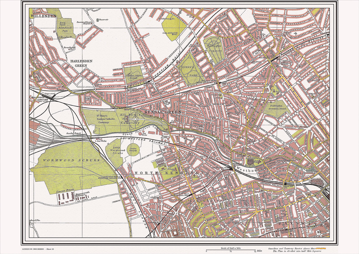
London in 1908 Series - showing Kensal Green, Kilburn area (Lon1908-10)
London in 1908 Series - showing Kensal Green, Kilburn area (Lon1908-10)
Couldn't load pickup availability
This digital download is a high-quality 300dpi JPG image of a street atlas map dated 1908. It is enlarged, and sized to print if required at A2 dimensions (59.4 cm x 42 cm), making it perfect for framing or use in a project. Or simply view it in close up on your computer screen using Windows Photo or similar.
This series of 1908 maps of London shows (where present) roads, farms, public buildings (such as hospitals, libraries, town halls, churches, schools, colleges, museums, gas works, sewage works, etc.) , larger houses, woods, rivers, estates and parks. They also show footpaths, ponds and lakes.
These maps are sharp and clear. All railway lines and stations are shown and named.
Kensal Green and Kilburn, located in the northwest of London, were both thriving residential areas in 1908, with a number of historical places of interest.
Kensal Green was known for its impressive Kensal Green Cemetery, which was opened in 1833 and was the final resting place of many notable figures, including authors, politicians, and members of the royal family. The area was also home to the historic St. John's Church, which was built in the 19th century and played an important role in the religious life of the area.
Kilburn was known for its bustling High Road, which was lined with a variety of shops, restaurants, and theaters. The area was also home to the historic Kilburn Priory, which was built in the 12th century and was one of the oldest buildings in the area.
Transportation in the area was provided by a network of trams and buses, which connected the area to the city center. Kensal Green and Kilburn were also known for their parks and green spaces, which included Queens Park and Grange Park, both popular destinations for visitors and locals.
Overall, Kensal Green and Kilburn in 1908 were characterized by their mix of historic landmarks, vibrant local businesses, and green spaces, which made them popular destinations for visitors and locals alike. Kensal Green Cemetery and St. John's Church were significant parts of the area's cultural heritage, while the High Road and local businesses added to the area's vibrancy and character. The parks and green spaces were popular destinations for visitors and locals alike, making the area a dynamic and thriving part of London.
Whether you're a history buff, a cartography enthusiast, or simply looking for a unique piece of decor for your home or office, this map is sure to delight. It's a piece of history that you can own and enjoy for years to come.