Elite Wall Decor
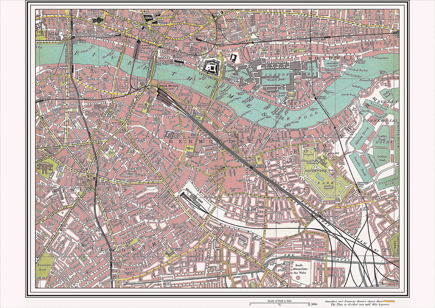
London in 1908 Series - showing Newington, Rotherhithe area (Lon1908-17)
London in 1908 Series - showing Newington, Rotherhithe area (Lon1908-17)
Couldn't load pickup availability
This digital download is a high-quality 300dpi JPG image of a street atlas map dated 1908. It is enlarged, and sized to print if required at A2 dimensions (59.4 cm x 42 cm), making it perfect for framing or use in a project. Or simply view it in close up on your computer screen using Windows Photo or similar.
This series of 1908 maps of London shows (where present) roads, farms, public buildings (such as hospitals, libraries, town halls, churches, schools, colleges, museums, gas works, sewage works, etc.) , larger houses, woods, rivers, estates and parks. They also show footpaths, ponds and lakes.
These maps are sharp and clear. All railway lines and stations are shown and named.
Newington and Rotherhithe were two neighborhoods located in the southeast of London in 1908. These areas were known for their rich history and several notable landmarks and places of interest.
One of the most significant landmarks in Newington was the St. Mary's Church, which dated back to the 12th century and was known for its impressive architecture and historical significance. The church was located near the famous Elephant and Castle, a busy intersection and a popular shopping destination at the time.
Rotherhithe, on the other hand, was known for its historical significance as a port town. The Rotherhithe Tunnel had recently been opened, providing a new means of transportation under the River Thames. The tunnel connected Rotherhithe to Wapping and allowed easier access to the London Docklands, which was a hub of commerce and industry at the time.
Another important landmark in Rotherhithe was the St. Mary's Church, which dated back to the 18th century and was known for its historical significance. The church was located near the famous Mayflower Pub, which commemorated the departure of the Pilgrims from Rotherhithe on their journey to America.
Transportation in the area was provided by a network of buses and trains, which connected Newington and Rotherhithe to other parts of the city. The nearby London Bridge Station provided access to the London Underground and the railway, making it easy to travel to other parts of London.
Overall, Newington and Rotherhithe in 1908 were characterized by their rich cultural history and their many landmarks and places of interest. The St. Mary's Church was a significant landmark in both neighborhoods, while the Elephant and Castle and the Rotherhithe Tunnel were notable attractions in Newington and Rotherhithe respectively. The transportation links provided easy access to other parts of the city, making the area an important hub of activity and commerce in early 20th century London.
Whether you're a history buff, a cartography enthusiast, or simply looking for a unique piece of decor for your home or office, this map is sure to delight. It's a piece of history that you can own and enjoy for years to come.