Elite Wall Decor
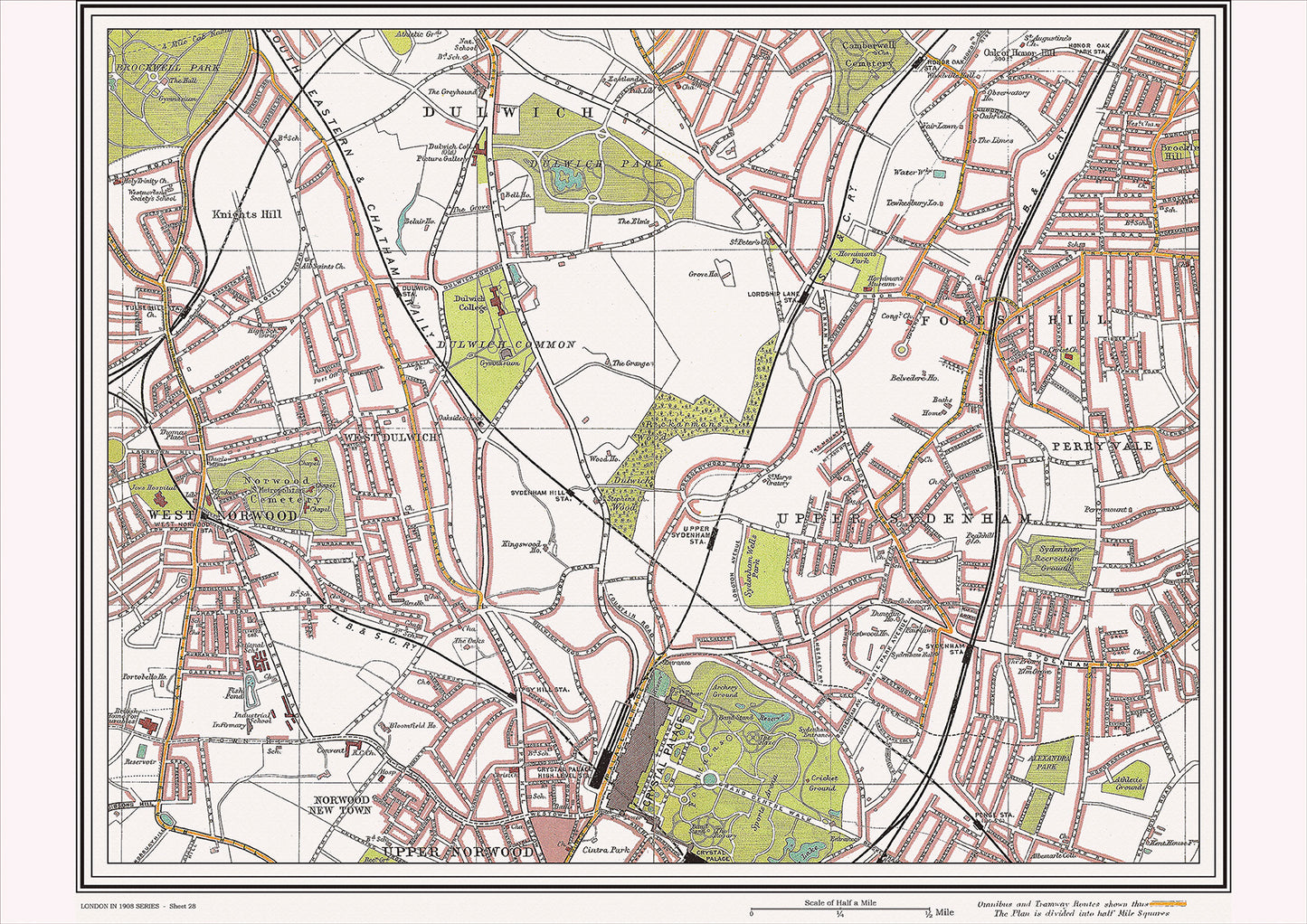
London in 1908 Series - showing Norwood, Sydenham area (Lon1908-28)
London in 1908 Series - showing Norwood, Sydenham area (Lon1908-28)
Couldn't load pickup availability
This digital download is a high-quality 300dpi JPG image of a street atlas map dated 1908. It is enlarged, and sized to print if required at A2 dimensions (59.4 cm x 42 cm), making it perfect for framing or use in a project. Or simply view it in close up on your computer screen using Windows Photo or similar.
This series of 1908 maps of London shows (where present) roads, farms, public buildings (such as hospitals, libraries, town halls, churches, schools, colleges, museums, gas works, sewage works, etc.) , larger houses, woods, rivers, estates and parks. They also show footpaths, ponds and lakes.
These maps are sharp and clear. All railway lines and stations are shown and named.
In 1908, Norwood and Sydenham were popular residential areas in South London. Norwood had several historic churches, including the Parish Church of St. Luke, which was built in the early 19th century and had a tower designed by Sir John Soane. Another notable church was All Saints' Church, which had a unique octagonal shape and was built in the late 19th century.
Sydenham was known for its impressive Crystal Palace, which was originally built for the Great Exhibition of 1851 in Hyde Park and was later moved to Sydenham. The Crystal Palace was a popular destination for visitors and housed a variety of exhibitions and displays.
Other notable attractions in the area included the Horniman Museum and Gardens, which opened in 1901 and had a collection of natural history specimens, musical instruments, and cultural artifacts. The Dulwich Picture Gallery was also a popular destination, featuring a collection of paintings from Old Masters such as Rembrandt, Rubens, and Gainsborough.
In terms of transportation, the Crystal Palace and Norwood Junction railway stations provided access to other parts of London. Additionally, the South Metropolitan Electric Tramways ran through the area, providing a convenient way to travel locally.
Whether you're a history buff, a cartography enthusiast, or simply looking for a unique piece of decor for your home or office, this map is sure to delight. It's a piece of history that you can own and enjoy for years to come.