Elite Wall Decor
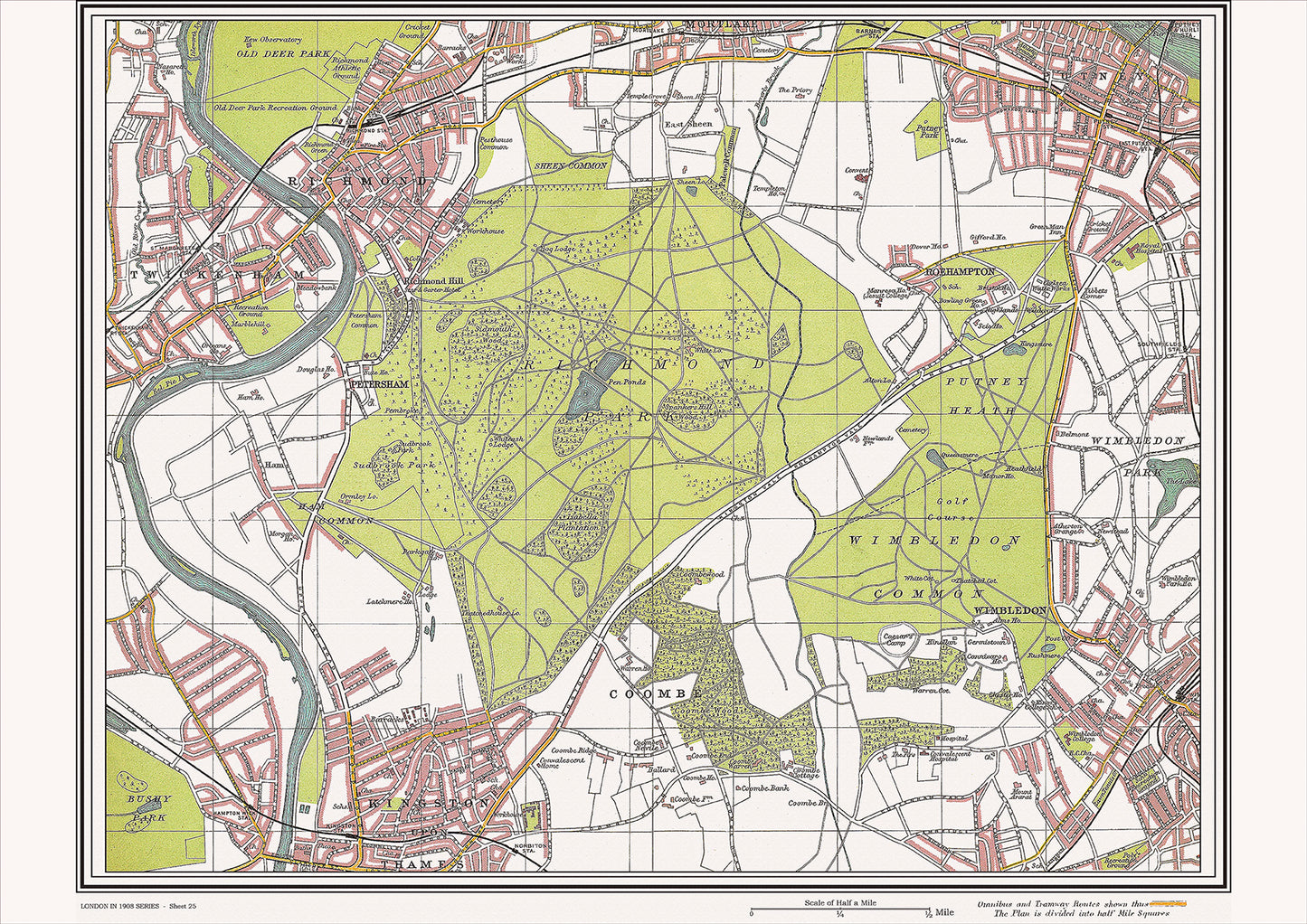
London in 1908 Series - showing Richmond, Wimbledon area (Lon1908-25)
London in 1908 Series - showing Richmond, Wimbledon area (Lon1908-25)
Couldn't load pickup availability
This digital download is a high-quality 300dpi JPG image of a street atlas map dated 1908. It is enlarged, and sized to print if required at A2 dimensions (59.4 cm x 42 cm), making it perfect for framing or use in a project. Or simply view it in close up on your computer screen using Windows Photo or similar.
This series of 1908 maps of London shows (where present) roads, farms, public buildings (such as hospitals, libraries, town halls, churches, schools, colleges, museums, gas works, sewage works, etc.) , larger houses, woods, rivers, estates and parks. They also show footpaths, ponds and lakes.
These maps are sharp and clear. All railway lines and stations are shown and named.
In 1908, Richmond and Wimbledon were two separate suburban districts located in the southwest of London, both with their own distinct character and historical landmarks.
Richmond was known for its beautiful riverside location and its well-preserved historical buildings. The town's centerpiece was Richmond Green, a large open space surrounded by a variety of shops, pubs, and restaurants. At one end of the green stood the historic Richmond Theatre, which had been built in 1899 and was still a popular venue for plays and musical performances.
Other historical landmarks in Richmond included the Richmond Bridge, which had been constructed in the 18th century and was still in use as a busy crossing over the River Thames, and the famous Richmond Hill, which provided stunning views of the river and surrounding countryside.
In terms of churches, the most prominent was likely St. Mary Magdalene Church, which had been built in the 16th century and was situated on the edge of the green.
Wimbledon, on the other hand, was known for its large open spaces and green areas, including Wimbledon Common, a large expanse of heathland and woodland that was popular for walking and picnicking. The town was also home to the famous All England Lawn Tennis and Croquet Club, which hosted the Wimbledon Championships each year.
Wimbledon's historical landmarks included the Wimbledon Windmill, a Grade II-listed building that had been constructed in the early 19th century and was still in operation, and the 12th-century St. Mary's Church, which was situated near the top of Wimbledon Hill and offered spectacular views of the surrounding area.
Other notable buildings in Wimbledon included the Wimbledon Theatre, which had been built in 1910 and was one of the largest theatres in south London, and the Wimbledon House, which had been built in the 17th century and was now home to the prestigious Donhead Preparatory School.
Whether you're a history buff, a cartography enthusiast, or simply looking for a unique piece of decor for your home or office, this map is sure to delight. It's a piece of history that you can own and enjoy for years to come.