Elite Wall Decor
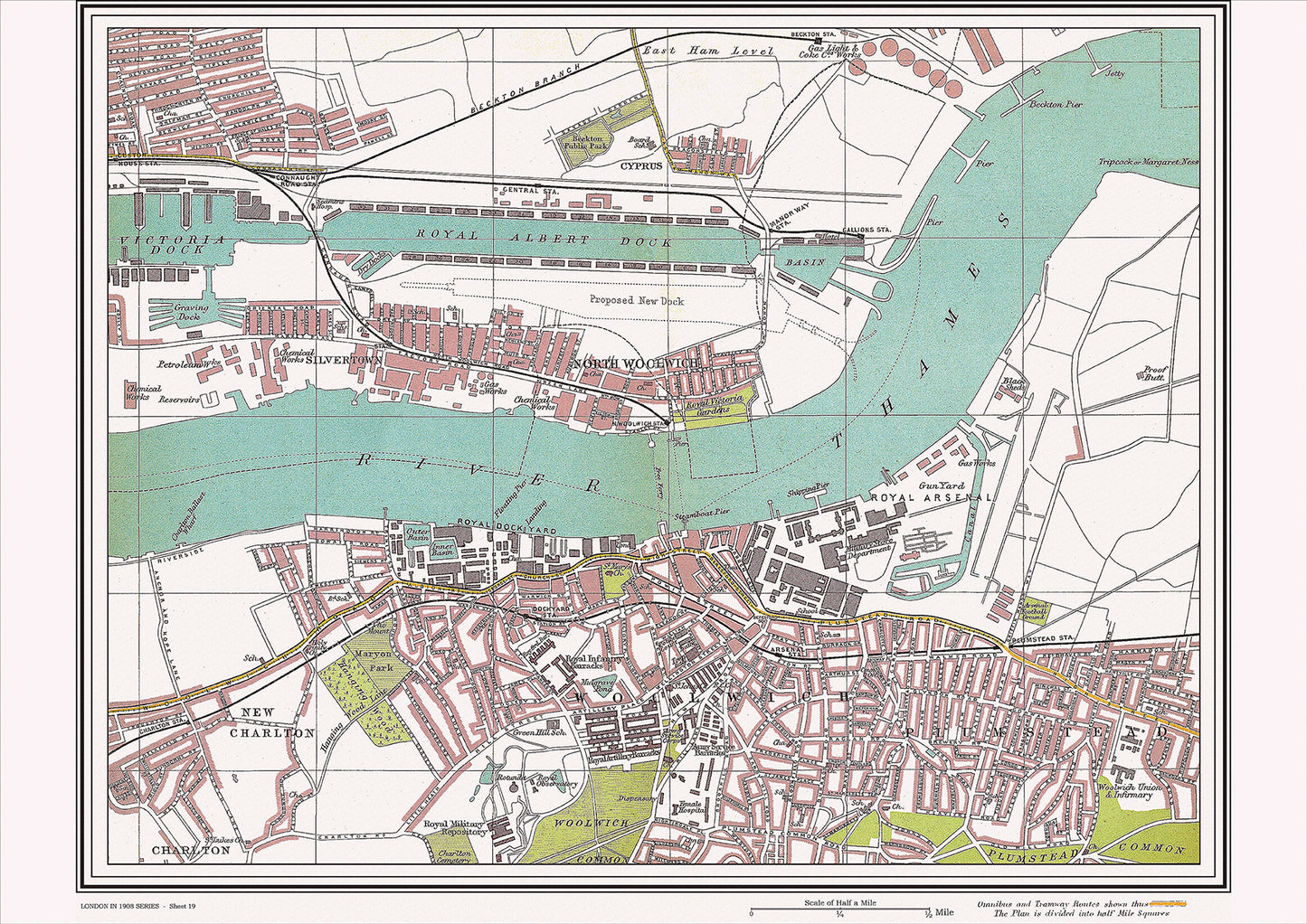
London in 1908 Series - showing Royal Albert Dock, Woolwich area (Lon1908-19)
London in 1908 Series - showing Royal Albert Dock, Woolwich area (Lon1908-19)
Couldn't load pickup availability
This digital download is a high-quality 300dpi JPG image of a street atlas map dated 1908. It is enlarged, and sized to print if required at A2 dimensions (59.4 cm x 42 cm), making it perfect for framing or use in a project. Or simply view it in close up on your computer screen using Windows Photo or similar.
This series of 1908 maps of London shows (where present) roads, farms, public buildings (such as hospitals, libraries, town halls, churches, schools, colleges, museums, gas works, sewage works, etc.) , larger houses, woods, rivers, estates and parks. They also show footpaths, ponds and lakes.
These maps are sharp and clear. All railway lines and stations are shown and named.
In 1908, the Royal Albert Dock in Woolwich was a bustling hub of trade and commerce. Located on the River Thames, it was one of the largest docks in London at the time, with a capacity for over 300 ships. The dock played a crucial role in the city's economy, handling imports and exports of goods from around the world.
Nearby, in the heart of Woolwich, was the Royal Arsenal, a major center for the manufacture and storage of weapons and ammunition for the British military. The Arsenal had a long history dating back to the 17th century, and during the 1900s, it employed thousands of workers and played a key role in supplying the armed forces during World War I.
There were several notable churches in the area, including St. Mary Magdalene Church in Woolwich, which was built in the 18th century and had a distinctive tower and spire. Another notable church was St. Peter's Church in nearby Charlton, which dated back to the 13th century and was known for its beautiful stained glass windows.
Other historical places of interest in the area included the Woolwich Town Hall, which was built in the late 19th century and housed the local government offices, as well as the Woolwich Foot Tunnel, which connected Woolwich to North Woolwich across the River Thames and opened in 1912. Additionally, the Royal Observatory in Greenwich, which was known for its contributions to astronomy and timekeeping, was located just a few miles downstream from the dock.
Whether you're a history buff, a cartography enthusiast, or simply looking for a unique piece of decor for your home or office, this map is sure to delight. It's a piece of history that you can own and enjoy for years to come.