Elite Wall Decor
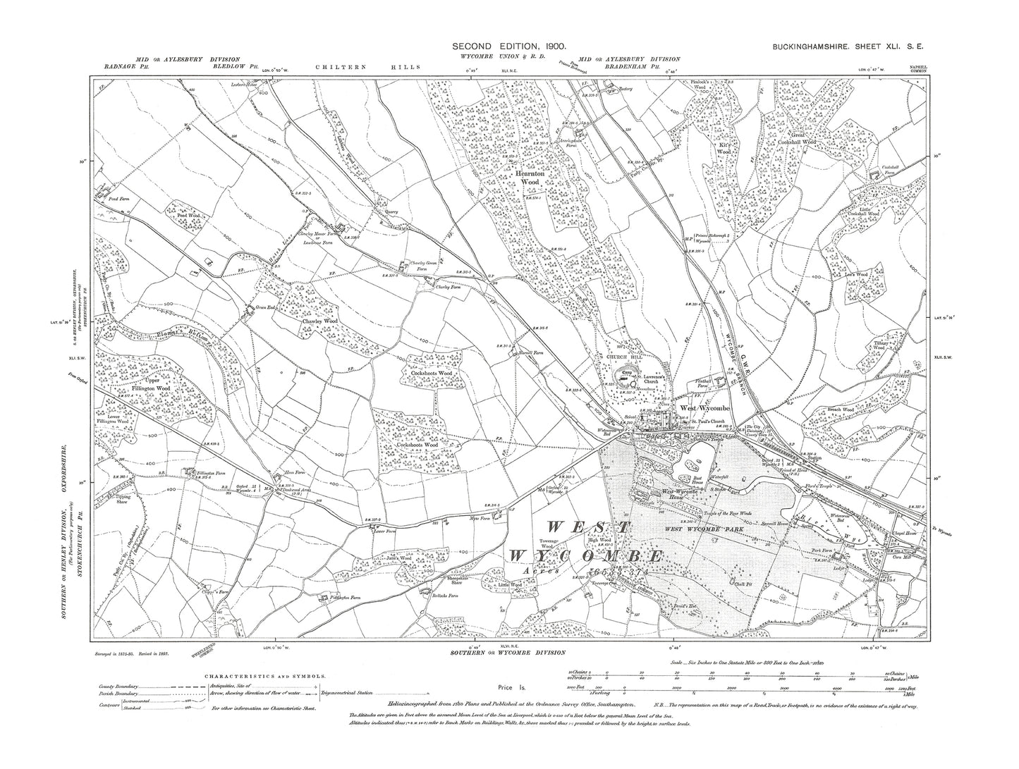
Old OS map dated 1900, showing West Wycombe in Buckinghamshire 41SE
Old OS map dated 1900, showing West Wycombe in Buckinghamshire 41SE
Couldn't load pickup availability
THIS IS SUPPLIED AS A JPG DIGITAL DOWNLOAD ONLY.
This digital download is a high-quality 300 dpi JPG image of a 1:10560 scale (6 inches to the mile) Ordnance Survey map sized to A2 dimensions (59.4 cm x 42 cm), making it perfect for viewing on your PC/Laptop, or for printing and framing.
The map provides a detailed view of the area, including the location of buildings, roads, railways, and other features. It also includes contours and spot heights, which provide information about the elevation of the terrain.
In 1900, West Wycombe was a village located in Buckinghamshire, England. The village is known for its connection to the Dashwood family, who were prominent in the area during the 18th century. The village's most notable landmark is the West Wycombe Park, a country house built in the 18th century by Sir Francis Dashwood.
The village is also home to the Church of St Lawrence, a medieval church that was restored in the 18th century by the Dashwood family. The church features a number of notable features, including a Norman font, a 14th-century tomb effigy, and a painted wooden pulpit.
Another notable landmark in West Wycombe is the Hellfire Caves, a series of man-made caves that were built in the 18th century as part of the Dashwood family's "Hellfire Club" meetings. The caves are open to visitors and offer a unique glimpse into the history of the area.
Overall, West Wycombe is a village steeped in history and offers visitors a chance to explore the area's connection to the Dashwood family and the 18th-century landscape movement.
Whether you're a history buff, a cartography enthusiast, or simply looking for a unique piece of decor for your home or office, this reproduction Ordnance Survey map is sure to delight. It's a piece of history that you can own and enjoy for years to come.

