Elite Wall Decor
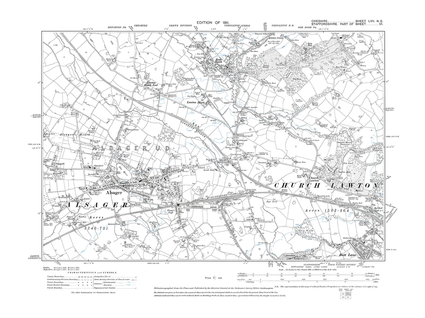
Old OS map dated 1911, showing Alsager, Rode Heath in Cheshire 57NE
Old OS map dated 1911, showing Alsager, Rode Heath in Cheshire 57NE
Couldn't load pickup availability
THIS IS SUPPLIED AS A DIGITAL DOWNLOAD ONLY.
This digital download is a high-quality 300 dpi JPG image of a 1:10560 scale (6 inches to the mile) Ordnance Survey map sized to A2 dimensions (59.4 cm x 42 cm), making it perfect for viewing on your PC/Laptop, or for printing and framing.
The map provides a detailed view of the area, including the location of buildings, roads, railways, and other features. It also includes contours and spot heights, which provide information about the elevation of the terrain.
In 1911, the small town of Alsager in Cheshire was a bustling center of industry, with several mills and factories producing silk, cotton, and other textiles. The town also had a strong agricultural tradition, with many local farms producing dairy and other products. The town's most notable landmark was the St. Mary Magdalene Church, which was built in the 14th century and stood at the center of the town. The church's imposing tower and ornate stained glass windows made it a popular destination for visitors and locals alike. Other places of interest in the area included the nearby villages of Rode Heath and Thurlwood, which were known for their picturesque countryside and charming rural architecture. Despite its industrial and agricultural heritage, Alsager was also a popular destination for tourists and visitors looking to escape the bustle of nearby cities like Stoke-on-Trent and Manchester.
Whether you're a history buff, a cartography enthusiast, or simply looking for a unique piece of decor for your home or office, this reproduction Ordnance Survey map is sure to delight. It's a piece of history that you can own and enjoy for years to come.