Elite Wall Decor
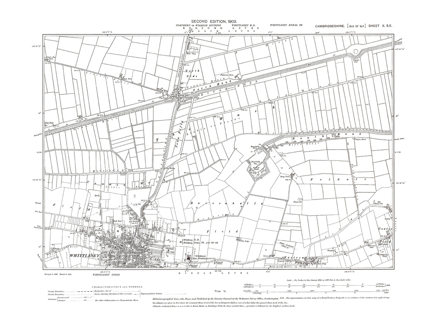
Old OS map dated 1903, showing Whittlesey (north), Eastrea in Cambridgeshire 10SE
Old OS map dated 1903, showing Whittlesey (north), Eastrea in Cambridgeshire 10SE
Couldn't load pickup availability
THIS IS SUPPLIED AS A JPG DIGITAL DOWNLOAD ONLY.
This digital download is a high-quality 300 dpi JPG image of a 1:10560 scale (6 inches to the mile) Ordnance Survey map sized to A2 dimensions (59.4 cm x 42 cm), making it perfect for viewing on your PC/Laptop, or for printing and framing.
The map provides a detailed view of the area, including the location of buildings, roads, railways, and other features. It also includes contours and spot heights, which provide information about the elevation of the terrain.
Whittlesey is a town located in the Fenland region of Cambridgeshire, England, with a long and fascinating history that dates back to the Roman times. The town is situated on the banks of the River Nene, which has played an important role in the town's development and economy.
One of the most notable historical places of interest in Whittlesey is the St. Mary's Church, which was built in the 15th century and is dedicated to Saint Mary. The church is a fine example of Perpendicular Gothic architecture, with its ornate stone carvings and beautiful stained glass windows. It also features a stunning octagonal tower and a medieval rood screen.
Aside from the church, there are several other historical places of interest in Whittlesey. The town is home to a number of well-preserved 17th and 18th century buildings, including the Old Court Hall, which was built in 1726 and served as a court of law for many years. The nearby Eastrea Chapel, which was built in the 19th century, is also worth a visit, as it provides a fascinating insight into the religious and cultural history of the region.
In 1903, Whittlesey was a thriving town with a population of just over 5,000 people. It was a bustling community, with a number of local businesses, including several pubs and inns, a brewery, and a coach building factory. The town also had its own railway station, which provided transport links to nearby cities and towns.
Overall, Whittlesey was a vibrant and historic town in 1903, with a rich cultural heritage that continues to be celebrated and preserved to this day. The St. Mary's Church remains an iconic landmark and a testament to the town's enduring history and tradition, while the Old Court Hall and Eastrea Chapel offer a glimpse into the town's fascinating past.
Whether you're a history buff, a cartography enthusiast, or simply looking for a unique piece of decor for your home or office, this reproduction Ordnance Survey map is sure to delight. It's a piece of history that you can own and enjoy for years to come.

