Elite Wall Decor
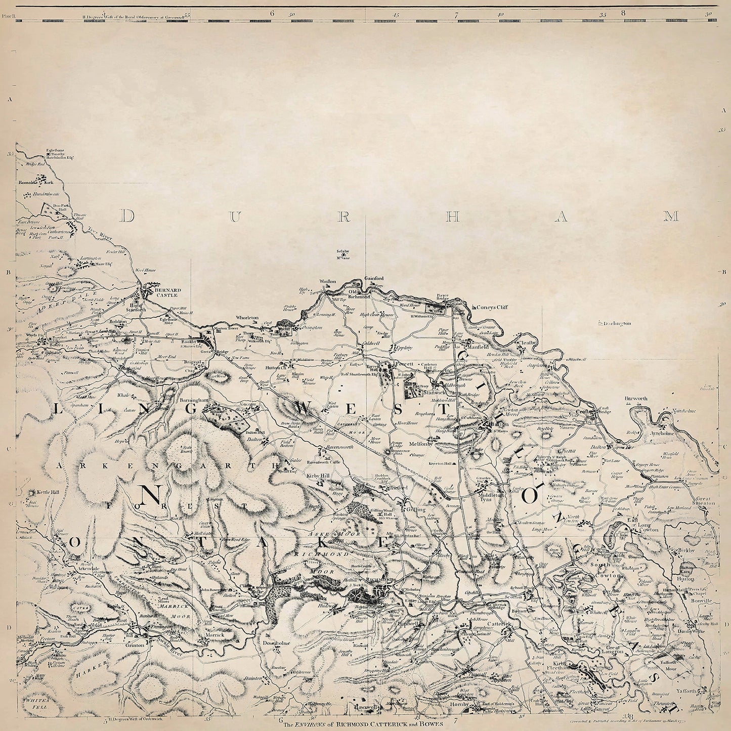
Yorkshire in 1771 sheet 1-2 - shows the Barnard Castle (Durham), Richmond area
Yorkshire in 1771 sheet 1-2 - shows the Barnard Castle (Durham), Richmond area
Couldn't load pickup availability
Downloading this large file to phones or tablets is not recommended
This digital download is a high-quality 300dpi JPG image of one sheet from Thomas Jefferys "The County of York Survey'd" published in 1771. The image is crisp, clear and easy to read. It measures 60 x 60 cm, or 7087 x 7087 pixels but can be cropped or resized with the appropriate software. Download now to print whole or in part at home, or simply view it in close up on your device using image software such as Adobe Photoshop, Gimp, Windows Photo, or similar.
Barnard Castle:
The town of Barnard Castle is situated on the banks of the River Tees in County Durham. Its environs were characterized by rolling hills, fertile farmland, and the scenic River Tees flowing through the landscape. The local economy was primarily centered around agriculture, with farming being the main occupation for the residents.
Farmers in the area cultivated crops such as wheat, barley, oats, and vegetables. They also raised livestock, including cattle, sheep, and pigs.
In addition to agriculture, Barnard Castle had emerging industries during the late 18th century. There were several mills along the River Tees, harnessing the power of water for milling grain, spinning textiles, and manufacturing goods. The town also had a thriving trade in lead mining, as the surrounding hills were rich in lead deposits. Lead mining provided employment opportunities for miners, smelters, and other workers associated with the industry.
Barnard Castle, after which the town is named, is a medieval fortress that dates back to the 12th century. It stands on a high rock above the River Tees and offers panoramic views of the surrounding countryside.
Richmond:
The town of Richmond is located in North Yorkshire and lies on the edge of the Yorkshire Dales National Park. The environs of Richmond were characterized by picturesque landscapes, including lush green meadows, rivers, and the nearby Swale Valley.
Similar to Barnard Castle, agriculture was the predominant occupation in the Richmond area. Farmers cultivated crops such as wheat, oats, barley, and vegetables, while also raising livestock such as cattle, sheep, and horses.
Richmond had a range of industries during the late 18th century. Textile manufacturing played a significant role, with several mills along the River Swale involved in producing textiles, including woolen cloth. The town also had a thriving market, attracting traders and merchants from surrounding areas.
Richmond Castle, a majestic medieval fortress, stands on a hill overlooking the town. It dates back to the 11th century and offers visitors a glimpse into the region's rich history. The cobbled marketplace in the town center was a hub of activity during this period, with local farmers, merchants, and tradespeople gathering for trade and commerce.