Elite Wall Decor
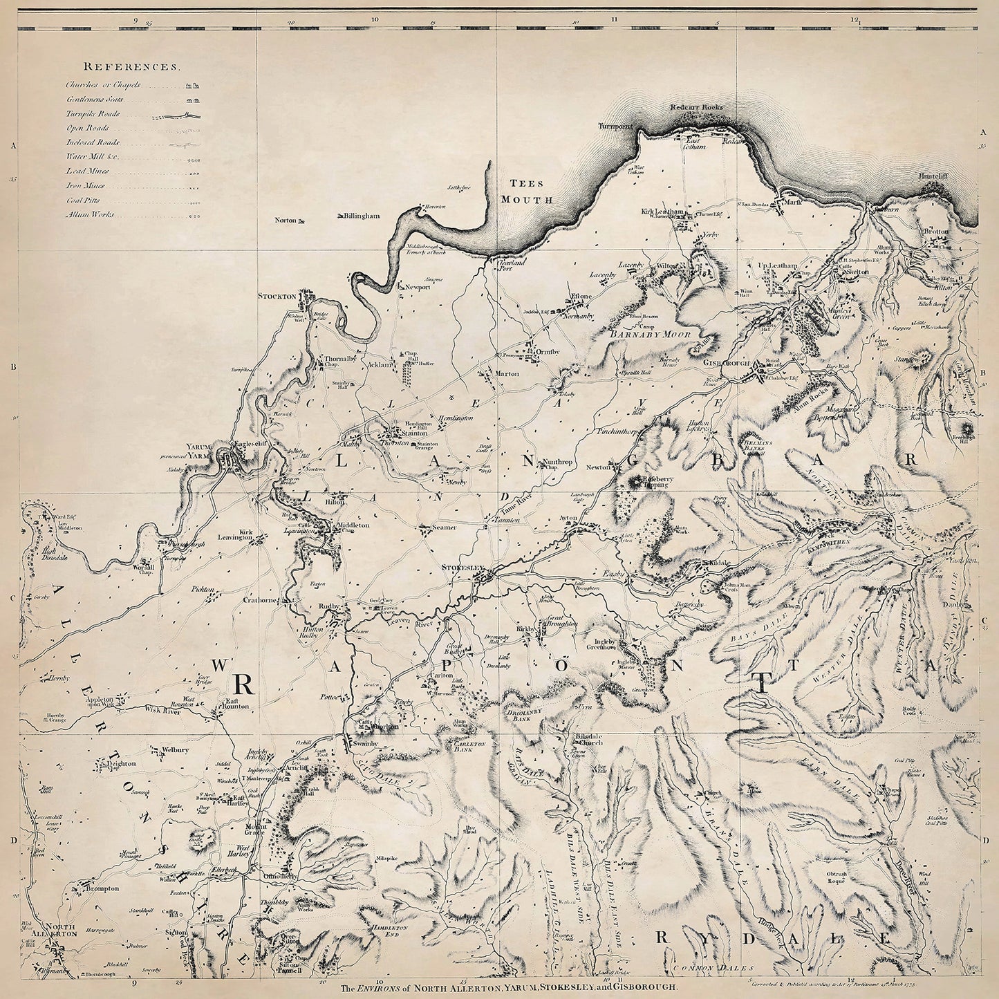
Yorkshire in 1771 sheet 1-3 - shows the Yarm, Stokesley, Gisborough, North Allerton area
Yorkshire in 1771 sheet 1-3 - shows the Yarm, Stokesley, Gisborough, North Allerton area
Couldn't load pickup availability
Downloading this large file to phones or tablets is not recommended
This digital download is a high-quality 300dpi JPG image of one sheet from Thomas Jefferys "The County of York Survey'd" published in 1771. The image is crisp, clear and easy to read. It measures 60 x 60 cm, or 7087 x 7087 pixels but can be cropped or resized with the appropriate software. Download now to print whole or in part at home, or simply view it in close up on your device using image software such as Adobe Photoshop, Gimp, Windows Photo, or similar.
Yarm:
Yarm is a historic market town located on the south bank of the River Tees. Its environs featured fertile farmland, rolling hills, and access to the river, which facilitated trade and transportation.
Agriculture was the primary occupation in Yarm and its surrounding areas. Farmers cultivated crops such as wheat, barley, oats, and vegetables, and also raised livestock, including cattle, sheep, and horses. Many individuals worked as laborers on farms.
The town had a busy market, attracting traders and merchants from the surrounding countryside, creating employment opportunities for shopkeepers, craftsmen, and others involved in trade.
Additionally, Yarm had a thriving shipbuilding industry due to its proximity to the River Tees. Shipbuilders constructed vessels, primarily for local trade and transportation.
Yarm boasted a historic and picturesque town center, featuring narrow cobbled streets and Georgian-style buildings. The town's medieval stone bridge over the River Tees, known as Yarm Bridge, was a notable landmark and an important crossing point.
Stokesley:
Stokesley is a market town situated on the edge of the North York Moors.
Agriculture was the primary occupation in Stokesley and its surrounding areas.
Stokesley had emerging industries during this period, including textiles and brewing. Textile manufacturing involved spinning wool and producing cloth, providing employment for spinners, weavers, and dyers. The brewing industry supported several breweries in the area, employing brewers, coopers, and other brewery workers.
Stokesley had a vibrant market, attracting traders and merchants from the surrounding villages and towns.
Guisborough:
Guisborough is a market town situated on the northern edge of the North York Moors. Its landscapes included moorland, forests, and agricultural fields.
Agriculture was the predominant occupation in Guisborough and its surroundings. Farmers cultivated crops such as wheat, barley, oats, and vegetables. Livestock farming, including cattle and sheep rearing, was also common.
Guisborough had some cottage industries, including textile production. Local artisans spun wool and produced cloth. Additionally, mining operations for ironstone and alum were conducted in the nearby hills.
Guisborough Priory, a medieval monastery in ruins, was a notable feature in the town. The priory attracted visitors and pilgrims, contributing to the local economy through tourism.